Neuberg geodata
Neuberg (Salzburg) is a populated place; located in Austria in Europe/Vienna (GMT+2) time zone. With population of 723 people, there are 1796 cities with bigger population in this country. Compared to other cities in Austria, 56.5% of cities are located further ↑North; 75.2% of cities are located further →East and 95.5% of cities have lower elevation than Neuberg. Note1
Administrative division(s):
- Level 1: Salzburg
- Level 2: Politischer Bezirk Sankt Johann im Pongau
- Level 3: Filzmoos


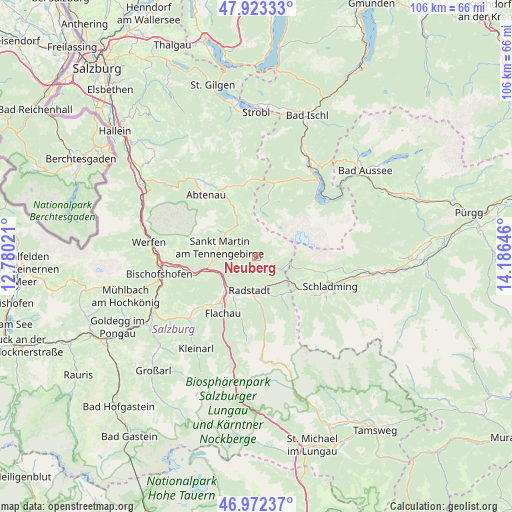
Neuberg GPS coordinates[2]
47° 27' 0" North, 13° 28' 59.988" East
| Map corner | latitude | longitude |
|---|---|---|
| Upper-left | 47.92333°, | 12.78021° |
| Center: | 47.45°, | 13.48333° |
| Lower-right: | 46.97237°, | 14.18646° |
| Map W x H: | 105.7×105.7 km | = 65.7×65.7mi |
| max Lat: | 48.98333° ⇑56.5% North |
| Neuberg: | 47.45° |
| min Lat: | ⇓43.5% South 46.48841° |
| min Long | Neuberg | max Long |
| 9.57802° | 13.48333° | 17.1° |
| W 24.8%⇐ | ⇒75.2% E |
Elevation
Elevation of Neuberg is 1046 m = 3432 ft, and this is 540.5 m = 1773 ft above average elevation for this country.
| Max E: |
2140 m = 7021 ft | 4.5% |
| Neuberg | 1046 m 3432 ft | |
| Avg. | 505.5 m = 1658 ft | |
Min E: |
118 m = 387 ft | 95.5% |
See also: Austria elevation on elevation.city.
Geographical zone
Neuberg is located in North temperate zone (between Tropic of Cancer and the Arctic Circle). Distance of this North polar circle is 2125.2 km =1320.5 mi to North.| Distance of | km | miles | from Neuberg |
|---|---|---|---|
| North Pole | 4731.1 | 2939.8 | to North |
| Arctic Circle | 2125.2 | 1320.5 | to North |
| Tropic Cancer | 2670 | 1659.1 | to South |
| Equator | 5275.9 | 3278.3 | to South |


Nearby cities:
15 places around Neuberg: (largest is in red/bold)
• Altenmarkt im Pongau
9 km =5.6 mi,  214°
214°
• Am Feuersang
11.2 km =7 mi, 214°
• Annaberg im Lammertal
8.2 km =5.1 mi,  331°
331°
• Eben im Pongau
8.4 km =5.2 mi,  228°
228°
• Filzmoos
3.1 km =1.9 mi,  126°
126°
• Forstau
9.6 km =6 mi,  145°
145°
• Höch
11.9 km =7.4 mi,  219°
219°
• Lammertal
10.2 km =6.3 mi,  300°
300°
• Löbenau
7.4 km =4.6 mi,  180°
180°
• Neubach
7.6 km =4.7 mi,  309°
309°
• Pichl
11.5 km =7.1 mi, 130°
• Radstadt
7.8 km =4.8 mi,  198°
198°
• Reitdorf
11.9 km =7.4 mi, 219°
• Schwemmberg
5.8 km =3.6 mi, 180°
• St. Martin of Tennengebirge
8.1 km =5 mi,  281°
281°
Sources, notices
• [Note1] Compared only with cities in Austria existing in our database
• [Src1] Map data: © OpenStreetMap contributors (CC-BY-SA)
• [Src2] Other city data from geonames.org with taken over terms of usage.
• [Src3] Geographical zone / Annual Mean Temperature by Robert A. Rohde @ Wikipedia
