Mühldorf geodata
Mühldorf (Upper Austria) is a populated place; located in Austria in Europe/Vienna (GMT+2) time zone. With population of 1,505 people, there are 838 cities with bigger population in this country. Compared to other cities in Austria, 60.9% of cities are located further ↓South; 65.9% of cities are located further →East and 60.6% of cities have lower elevation than Mühldorf. Note1
Administrative division(s):
- Level 1: Upper Austria
- Level 2: Politischer Bezirk Gmunden
- Level 3: Scharnstein


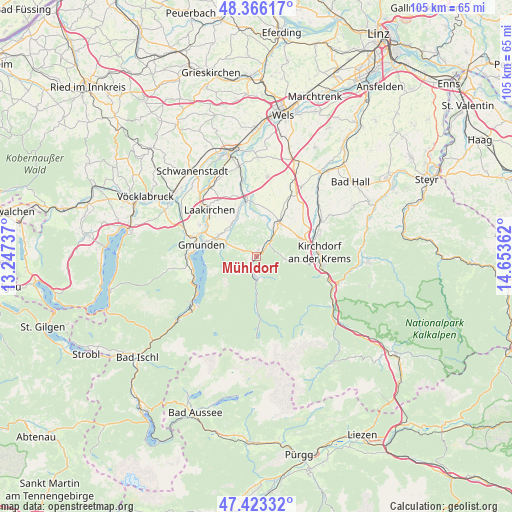
Mühldorf GPS coordinates[2]
47° 53' 48.804" North, 13° 57' 1.764" East
| Map corner | latitude | longitude |
|---|---|---|
| Upper-left | 48.36617°, | 13.24737° |
| Center: | 47.89689°, | 13.95049° |
| Lower-right: | 47.42332°, | 14.65362° |
| Map W x H: | 104.8×104.8 km | = 65.1×65.1mi |
| max Lat: | 48.98333° ⇑39.1% North |
| Mühldorf: | 47.89689° |
| min Lat: | ⇓60.9% South 46.48841° |
| min Long | Mühldorf | max Long |
| 9.57802° | 13.95049° | 17.1° |
| W 34.1%⇐ | ⇒65.9% E |
Elevation
Elevation of Mühldorf is 522 m = 1713 ft, and this is 16.5 m = 54 ft above average elevation for this country.
| Max E: |
2140 m = 7021 ft | 39.4% |
| Mühldorf | 522 m 1713 ft | |
| Avg. | 505.5 m = 1658 ft | |
Min E: |
118 m = 387 ft | 60.6% |
See also: Austria elevation on elevation.city.
Geographical zone
Mühldorf is located in North temperate zone (between Tropic of Cancer and the Arctic Circle). Distance of this North polar circle is 2075.5 km =1289.7 mi to North.| Distance of | km | miles | from Mühldorf |
|---|---|---|---|
| North Pole | 4681.4 | 2908.9 | to North |
| Arctic Circle | 2075.5 | 1289.7 | to North |
| Tropic Cancer | 2719.7 | 1689.9 | to South |
| Equator | 5325.6 | 3309.2 | to South |


Nearby cities:
15 places around Mühldorf: (largest is in red/bold)
• Dorf
0.7 km =0.4 mi,  323°
323°
• Dürndorf
8.3 km =5.2 mi,  36°
36°
• Gmunden
11.5 km =7.1 mi,  281°
281°
• Grünau im Almtal
4.7 km =2.9 mi,  175°
175°
• Gschwandt
8.9 km =5.5 mi,  298°
298°
• Inzersdorf im Kremstal
10.3 km =6.4 mi,  70°
70°
• Kirchham
9.1 km =5.7 mi,  334°
334°
• Mitterndorf
7.3 km =4.5 mi,  29°
29°
• Pettenbach
8.6 km =5.3 mi, 35°
• Pratsdorf
9.6 km =6 mi,  47°
47°
• Sankt Konrad
5 km =3.1 mi,  290°
290°
• Scharnstein
1.2 km =0.7 mi, 44°
• Steinbach am Ziehberg
6 km =3.7 mi,  94°
94°
• Viechtwang
2.3 km =1.4 mi, 25°
• Vorchdorf
12.1 km =7.5 mi,  349°
349°
Sources, notices
• [Note1] Compared only with cities in Austria existing in our database
• [Src1] Map data: © OpenStreetMap contributors (CC-BY-SA)
• [Src2] Other city data from geonames.org with taken over terms of usage.
• [Src3] Geographical zone / Annual Mean Temperature by Robert A. Rohde @ Wikipedia
