Gschwandt geodata
Gschwandt (Upper Austria) is a seat of a third-order administrative division; located in Austria in Europe/Vienna (GMT+2) time zone. With population of 1,782 people, there are 698 cities with bigger population in this country. Compared to other cities in Austria, 62.5% of cities are located further ↓South; 68.2% of cities are located further →East and 60.3% of cities have lower elevation than Gschwandt. Note1
Administrative division(s):
- Level 1: Upper Austria
- Level 2: Politischer Bezirk Gmunden
- Level 3: Gschwandt


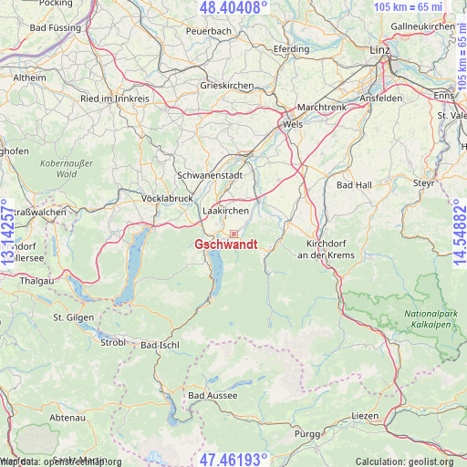
Gschwandt GPS coordinates[2]
47° 56' 6.54" North, 13° 50' 44.484" East
| Map corner | latitude | longitude |
|---|---|---|
| Upper-left | 48.40408°, | 13.14257° |
| Center: | 47.93515°, | 13.84569° |
| Lower-right: | 47.46193°, | 14.54882° |
| Map W x H: | 104.8×104.8 km | = 65.1×65.1mi |
| max Lat: | 48.98333° ⇑37.5% North |
| Gschwandt: | 47.93515° |
| min Lat: | ⇓62.5% South 46.48841° |
| min Long | Gschwandt | max Long |
| 9.57802° | 13.84569° | 17.1° |
| W 31.8%⇐ | ⇒68.2% E |
Elevation
Elevation of Gschwandt is 519 m = 1703 ft, and this is 13.5 m = 44 ft above average elevation for this country.
| Max E: |
2140 m = 7021 ft | 39.7% |
| Gschwandt | 519 m 1703 ft | |
| Avg. | 505.5 m = 1658 ft | |
Min E: |
118 m = 387 ft | 60.3% |
See also: Austria elevation on elevation.city.
Geographical zone
Gschwandt is located in North temperate zone (between Tropic of Cancer and the Arctic Circle). Distance of this North polar circle is 2071.3 km =1287 mi to North.| Distance of | km | miles | from Gschwandt |
|---|---|---|---|
| North Pole | 4677.2 | 2906.3 | to North |
| Arctic Circle | 2071.3 | 1287 | to North |
| Tropic Cancer | 2724 | 1692.6 | to South |
| Equator | 5329.9 | 3311.8 | to South |


Nearby cities:
15 places around Gschwandt: (largest is in red/bold)
• Altmünster
7.1 km =4.4 mi,  238°
238°
• Dorf
8.3 km =5.2 mi,  116°
116°
• Eck
5.7 km =3.5 mi,  250°
250°
• Gmunden
3.9 km =2.4 mi, 241°
• Großkufhaus
8.2 km =5.1 mi,  259°
259°
• Kirchham
5.6 km =3.5 mi,  44°
44°
• Kleinreith
3.8 km =2.4 mi,  279°
279°
• Laakirchen
5.5 km =3.4 mi,  340°
340°
• Mühldorf
8.9 km =5.5 mi, 118°
• Ohlsdorf
4.9 km =3 mi,  305°
305°
• Pinsdorf
5.6 km =3.5 mi, 263°
• Sankt Konrad
4 km =2.5 mi,  128°
128°
• Scharnstein
9.3 km =5.8 mi,  111°
111°
• Viechtwang
9 km =5.6 mi,  104°
104°
• Wiesen
7.2 km =4.5 mi, 281°
Sources, notices
• [Note1] Compared only with cities in Austria existing in our database
• [Src1] Map data: © OpenStreetMap contributors (CC-BY-SA)
• [Src2] Other city data from geonames.org with taken over terms of usage.
• [Src3] Geographical zone / Annual Mean Temperature by Robert A. Rohde @ Wikipedia
