Möggers geodata
Möggers (Vorarlberg) is a seat of a third-order administrative division; located in Austria in Europe/Vienna (GMT+2) time zone. With population of 534 people, there are 2378 cities with bigger population in this country. Compared to other cities in Austria, 51% of cities are located further ↑North; 98.2% of cities are located further →East and 89.7% of cities have lower elevation than Möggers. Note1
Administrative division(s):
- Level 1: Vorarlberg
- Level 2: Politischer Bezirk Bregenz
- Level 3: Möggers


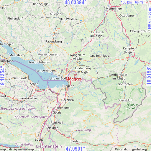
Möggers GPS coordinates[2]
47° 34' 0.012" North, 9° 49' 0.012" East
| Map corner | latitude | longitude |
|---|---|---|
| Upper-left | 48.03894°, | 9.11354° |
| Center: | 47.56667°, | 9.81667° |
| Lower-right: | 47.0901°, | 10.5198° |
| Map W x H: | 105.5×105.5 km | = 65.6×65.6mi |
| max Lat: | 48.98333° ⇑51% North |
| Möggers: | 47.56667° |
| min Lat: | ⇓49% South 46.48841° |
| min Long | Möggers | max Long |
| 9.57802° | 9.81667° | 17.1° |
| W 1.8%⇐ | ⇒98.2% E |
Elevation
Elevation of Möggers is 874 m = 2867 ft, and this is 368.5 m = 1209 ft above average elevation for this country.
| Max E: |
2140 m = 7021 ft | 10.3% |
| Möggers | 874 m 2867 ft | |
| Avg. | 505.5 m = 1658 ft | |
Min E: |
118 m = 387 ft | 89.7% |
See also: Austria elevation on elevation.city.
Geographical zone
Möggers is located in North temperate zone (between Tropic of Cancer and the Arctic Circle). Distance of this North polar circle is 2112.3 km =1312.5 mi to North.| Distance of | km | miles | from Möggers |
|---|---|---|---|
| North Pole | 4718.1 | 2931.7 | to North |
| Arctic Circle | 2112.3 | 1312.5 | to North |
| Tropic Cancer | 2683 | 1667.1 | to South |
| Equator | 5288.9 | 3286.4 | to South |


Nearby cities:
15 places around Möggers: (largest is in red/bold)
• Bregenz
8.8 km =5.5 mi,  216°
216°
• Buch
9 km =5.6 mi,  177°
177°
• Doren
9.5 km =5.9 mi,  150°
150°
• Eichenberg
4.5 km =2.8 mi,  214°
214°
• Hohenweiler
3.1 km =1.9 mi,  306°
306°
• Hörbranz
5.3 km =3.3 mi,  249°
249°
• Kennelbach
10 km =6.2 mi,  201°
201°
• Krumbach
12.9 km =8 mi,  136°
136°
• Langen
5.6 km =3.5 mi, 180°
• Langenegg
12.4 km =7.7 mi, 150°
• Lauterach
12 km =7.5 mi, 212°
• Lochau
6.2 km =3.9 mi,  233°
233°
• Riefensberg
12.9 km =8 mi,  124°
124°
• Sulzberg
8.8 km =5.5 mi, 124°
• Wolfurt
12.2 km =7.6 mi, 204°
Sources, notices
• [Note1] Compared only with cities in Austria existing in our database
• [Src1] Map data: © OpenStreetMap contributors (CC-BY-SA)
• [Src2] Other city data from geonames.org with taken over terms of usage.
• [Src3] Geographical zone / Annual Mean Temperature by Robert A. Rohde @ Wikipedia
