Mödling geodata
Mödling (Lower Austria) is a seat of a third-order administrative division; located in Austria in Europe/Vienna (GMT+2) time zone. With population of 20,555 people, there are 30 cities with bigger population in this country. Compared to other cities in Austria, 72% of cities are located further ↓South; 88.4% of cities are located further ←West and 88.9% of cities have higher elevation than Mödling. Note1
Administrative division(s):
- Level 1: Lower Austria
- Level 2: Politischer Bezirk Mödling
- Level 3: Mödling


Mödling GPS coordinates[2]
48° 5' 9.78" North, 16° 17' 21.156" East
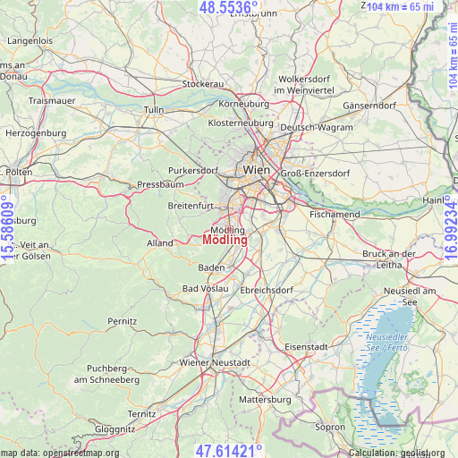
| Map corner | latitude | longitude |
|---|---|---|
| Upper-left | 48.5536°, | 15.58609° |
| Center: | 48.08605°, | 16.28921° |
| Lower-right: | 47.61421°, | 16.99234° |
| Map W x H: | 104.5×104.4 km | = 64.9×64.9mi |
| max Lat: | 48.98333° ⇑28% North |
| Mödling: | 48.08605° |
| min Lat: | ⇓72% South 46.48841° |
| min Long | Mödling | max Long |
| 9.57802° | 16.28921° | 17.1° |
| W 88.4%⇐ | ⇒11.6% E |
Elevation
Elevation of Mödling is 222 m = 728 ft, and this is 283.5 m = 930 ft below average elevation for this country.
| Max E: |
2140 m = 7021 ft | 88.9% |
| Avg. | 505.5 m = 1658 ft | |
| Mödling | 222 m = 728 ft | |
Min E: |
118 m = 387 ft | 11.1% |
See also: Austria elevation on elevation.city.
Geographical zone
Mödling is located in North temperate zone (between Tropic of Cancer and the Arctic Circle). Distance of this North polar circle is 2054.5 km =1276.6 mi to North.| Distance of | km | miles | from Mödling |
|---|---|---|---|
| North Pole | 4660.4 | 2895.8 | to North |
| Arctic Circle | 2054.5 | 1276.6 | to North |
| Tropic Cancer | 2740.7 | 1703 | to South |
| Equator | 5346.7 | 3322.3 | to South |


Nearby cities:
15 places around Mödling: (largest is in red/bold)
• Achau
7.2 km =4.5 mi,  95°
95°
• Biedermannsdorf
4.2 km =2.6 mi,  93°
93°
• Brunn am Gebirge
2.4 km =1.5 mi,  351°
351°
• Gießhübl
4.2 km =2.6 mi,  287°
287°
• Gumpoldskirchen
4.6 km =2.9 mi,  191°
191°
• Guntramsdorf
4.7 km =2.9 mi,  157°
157°
• Hennersdorf
6.2 km =3.9 mi,  62°
62°
• Hinterbrühl
3.1 km =1.9 mi,  270°
270°
• Laxenburg
5.3 km =3.3 mi,  111°
111°
• Maria Enzersdorf
1.6 km =1 mi,  344°
344°
• Möllersdorf
6.8 km =4.2 mi,  170°
170°
• Neu-Guntramsdorf
3.1 km =1.9 mi,  140°
140°
• Perchtoldsdorf
4.1 km =2.5 mi, 335°
• Vösendorf
5.4 km =3.4 mi,  44°
44°
• Wiener Neudorf
1.9 km =1.2 mi, 101°
Sources, notices
• [Note1] Compared only with cities in Austria existing in our database
• [Src1] Map data: © OpenStreetMap contributors (CC-BY-SA)
• [Src2] Other city data from geonames.org with taken over terms of usage.
• [Src3] Geographical zone / Annual Mean Temperature by Robert A. Rohde @ Wikipedia
