Guntramsdorf geodata
Guntramsdorf (Lower Austria) is a seat of a third-order administrative division; located in Austria in Europe/Vienna (GMT+2) time zone. With population of 9,179 people, there are 91 cities with bigger population in this country. Compared to other cities in Austria, 69.4% of cities are located further ↓South; 89% of cities are located further ←West and 93.6% of cities have higher elevation than Guntramsdorf. Note1
Administrative division(s):
- Level 1: Lower Austria
- Level 2: Politischer Bezirk Mödling
- Level 3: Guntramsdorf


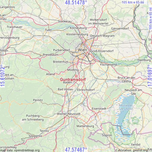
Guntramsdorf GPS coordinates[2]
48° 2' 48.732" North, 16° 18' 49.824" East
| Map corner | latitude | longitude |
|---|---|---|
| Upper-left | 48.51478°, | 15.61072° |
| Center: | 48.04687°, | 16.31384° |
| Lower-right: | 47.57467°, | 17.01697° |
| Map W x H: | 104.5×104.5 km | = 64.9×64.9mi |
| max Lat: | 48.98333° ⇑30.6% North |
| Guntramsdorf: | 48.04687° |
| min Lat: | ⇓69.4% South 46.48841° |
| min Long | Guntramsdorf | max Long |
| 9.57802° | 16.31384° | 17.1° |
| W 89%⇐ | ⇒11% E |
Elevation
Elevation of Guntramsdorf is 188 m = 617 ft, and this is 317.5 m = 1042 ft below average elevation for this country.
| Max E: |
2140 m = 7021 ft | 93.6% |
| Avg. | 505.5 m = 1658 ft | |
| Guntramsdorf | 188 m = 617 ft | |
Min E: |
118 m = 387 ft | 6.4% |
See also: Austria elevation on elevation.city.
Geographical zone
Guntramsdorf is located in North temperate zone (between Tropic of Cancer and the Arctic Circle). Distance of this North polar circle is 2058.9 km =1279.3 mi to North.| Distance of | km | miles | from Guntramsdorf |
|---|---|---|---|
| North Pole | 4664.8 | 2898.6 | to North |
| Arctic Circle | 2058.9 | 1279.3 | to North |
| Tropic Cancer | 2736.4 | 1700.3 | to South |
| Equator | 5342.3 | 3319.6 | to South |


Nearby cities:
15 places around Guntramsdorf: (largest is in red/bold)
• Achau
6.5 km =4 mi,  55°
55°
• Biedermannsdorf
4.7 km =2.9 mi,  29°
29°
• Gumpoldskirchen
2.7 km =1.7 mi,  266°
266°
• Laxenburg
3.9 km =2.4 mi,  52°
52°
• Maria Enzersdorf
6.3 km =3.9 mi,  339°
339°
• Mödling
4.7 km =2.9 mi, 337°
• Möllersdorf
2.4 km =1.5 mi,  195°
195°
• Münchendorf
5.4 km =3.4 mi,  106°
106°
• Neu-Guntramsdorf
1.9 km =1.2 mi,  4°
4°
• Pfaffstätten
5 km =3.1 mi,  228°
228°
• Traiskirchen
3.9 km =2.4 mi, 203°
• Tribuswinkel
5.5 km =3.4 mi,  215°
215°
• Trumau
6.3 km =3.9 mi,  160°
160°
• Wiener Neudorf
4 km =2.5 mi, 0°
• Wienersdorf
4.6 km =2.9 mi, 200°
Sources, notices
• [Note1] Compared only with cities in Austria existing in our database
• [Src1] Map data: © OpenStreetMap contributors (CC-BY-SA)
• [Src2] Other city data from geonames.org with taken over terms of usage.
• [Src3] Geographical zone / Annual Mean Temperature by Robert A. Rohde @ Wikipedia
