Mauern geodata
Mauern (Tyrol) is a populated place; located in Austria in Europe/Vienna (GMT+2) time zone. With population of 572 people, there are 2240 cities with bigger population in this country. Compared to other cities in Austria, 79.3% of cities are located further ↑North; 91.5% of cities are located further →East and 95.5% of cities have lower elevation than Mauern. Note1
Administrative division(s):
- Level 1: Tyrol
- Level 2: Politischer Bezirk Innsbruck Land
- Level 3: Steinach am Brenner


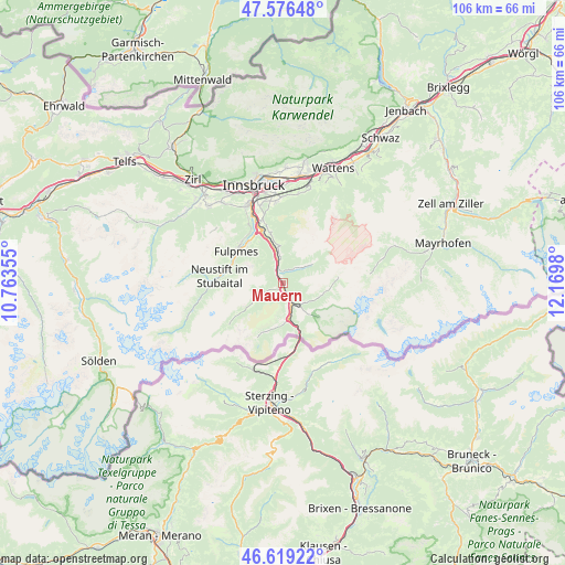
Mauern GPS coordinates[2]
47° 6' 0" North, 11° 28' 0.012" East
| Map corner | latitude | longitude |
|---|---|---|
| Upper-left | 47.57648°, | 10.76355° |
| Center: | 47.1°, | 11.46667° |
| Lower-right: | 46.61922°, | 12.1698° |
| Map W x H: | 106.4×106.4 km | = 66.1×66.1mi |
| max Lat: | 48.98333° ⇑79.3% North |
| Mauern: | 47.1° |
| min Lat: | ⇓20.7% South 46.48841° |
| min Long | Mauern | max Long |
| 9.57802° | 11.46667° | 17.1° |
| W 8.5%⇐ | ⇒91.5% E |
Elevation
Elevation of Mauern is 1046 m = 3432 ft, and this is 540.5 m = 1773 ft above average elevation for this country.
| Max E: |
2140 m = 7021 ft | 4.5% |
| Mauern | 1046 m 3432 ft | |
| Avg. | 505.5 m = 1658 ft | |
Min E: |
118 m = 387 ft | 95.5% |
See also: Austria elevation on elevation.city.
Geographical zone
Mauern is located in North temperate zone (between Tropic of Cancer and the Arctic Circle). Distance of this North polar circle is 2164.1 km =1344.7 mi to North.| Distance of | km | miles | from Mauern |
|---|---|---|---|
| North Pole | 4770 | 2963.9 | to North |
| Arctic Circle | 2164.1 | 1344.7 | to North |
| Tropic Cancer | 2631.1 | 1634.9 | to South |
| Equator | 5237 | 3254.1 | to South |


Nearby cities:
15 places around Mauern: (largest is in red/bold)
• Ausserweg
3.9 km =2.4 mi,  18°
18°
• Außerschmirn
5.4 km =3.4 mi,  110°
110°
• Ellbögen
7.5 km =4.7 mi,  350°
350°
• Gries am Brenner
6.9 km =4.3 mi,  170°
170°
• Matrei am Brenner
3.3 km =2.1 mi,  340°
340°
• Mieders
9.7 km =6 mi,  319°
319°
• Mühlbachl
3.9 km =2.4 mi, 341°
• Oberweg
5.3 km =3.3 mi,  45°
45°
• Pfons
4.7 km =2.9 mi, 354°
• Schmirn
7.8 km =4.8 mi,  103°
103°
• Schöfens
3.9 km =2.4 mi, 352°
• Statz
2.2 km =1.4 mi,  325°
325°
• Steinach am Brenner
1.9 km =1.2 mi,  180°
180°
• Trins
4.2 km =2.6 mi,  243°
243°
• Vals
7.9 km =4.9 mi,  140°
140°
Sources, notices
• [Note1] Compared only with cities in Austria existing in our database
• [Src1] Map data: © OpenStreetMap contributors (CC-BY-SA)
• [Src2] Other city data from geonames.org with taken over terms of usage.
• [Src3] Geographical zone / Annual Mean Temperature by Robert A. Rohde @ Wikipedia
