Kühnsdorf geodata
Kühnsdorf (Carinthia) is a populated place; located in Austria in Europe/Vienna (GMT+2) time zone. With population of 1,521 people, there are 828 cities with bigger population in this country. Compared to other cities in Austria, 97.7% of cities are located further ↑North; 51.1% of cities are located further →East and 51.9% of cities have higher elevation than Kühnsdorf. Note1
Administrative division(s):
- Level 1: Carinthia
- Level 2: Politischer Bezirk Völkermarkt
- Level 3: Eberndorf


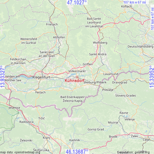
Kühnsdorf GPS coordinates[2]
46° 37' 18.984" North, 14° 38' 11.004" East
| Map corner | latitude | longitude |
|---|---|---|
| Upper-left | 47.1027°, | 13.93327° |
| Center: | 46.62194°, | 14.63639° |
| Lower-right: | 46.13687°, | 15.33952° |
| Map W x H: | 107.4×107.4 km | = 66.7×66.7mi |
| max Lat: | 48.98333° ⇑97.7% North |
| Kühnsdorf: | 46.62194° |
| min Lat: | ⇓2.3% South 46.48841° |
| min Long | Kühnsdorf | max Long |
| 9.57802° | 14.63639° | 17.1° |
| W 48.9%⇐ | ⇒51.1% E |
Elevation
Elevation of Kühnsdorf is 439 m = 1440 ft, and this is 66.5 m = 218 ft below average elevation for this country.
| Max E: |
2140 m = 7021 ft | 51.9% |
| Avg. | 505.5 m = 1658 ft | |
| Kühnsdorf | 439 m = 1440 ft | |
Min E: |
118 m = 387 ft | 48.1% |
See also: Austria elevation on elevation.city.
Geographical zone
Kühnsdorf is located in North temperate zone (between Tropic of Cancer and the Arctic Circle). Distance of this North polar circle is 2217.3 km =1377.8 mi to North.| Distance of | km | miles | from Kühnsdorf |
|---|---|---|---|
| North Pole | 4823.2 | 2997 | to North |
| Arctic Circle | 2217.3 | 1377.8 | to North |
| Tropic Cancer | 2578 | 1601.9 | to South |
| Equator | 5183.9 | 3221.1 | to South |


Nearby cities:
15 places around Kühnsdorf: (largest is in red/bold)
• Eberndorf
3.4 km =2.1 mi,  170°
170°
• Ebersdorf
12 km =7.5 mi,  110°
110°
• Feistritz ob Bleiburg
12.8 km =8 mi,  128°
128°
• Gallizien
12.2 km =7.6 mi,  228°
228°
• Globasnitz
8.8 km =5.5 mi,  144°
144°
• Griffen
11.8 km =7.3 mi,  38°
38°
• Gösselsdorf
5.4 km =3.4 mi,  180°
180°
• Leibsdorf
12.8 km =8 mi,  285°
285°
• Mittlern
6.8 km =4.2 mi, 106°
• Ruden
11.4 km =7.1 mi,  69°
69°
• Sankt Michael ob Bleiburg
9.5 km =5.9 mi,  120°
120°
• Sittersdorf
8.9 km =5.5 mi,  195°
195°
• Tainach
8 km =5 mi,  279°
279°
• Völkermarkt
4.5 km =2.8 mi,  358°
358°
• Wasserhofen
1.6 km =1 mi,  248°
248°
Sources, notices
• [Note1] Compared only with cities in Austria existing in our database
• [Src1] Map data: © OpenStreetMap contributors (CC-BY-SA)
• [Src2] Other city data from geonames.org with taken over terms of usage.
• [Src3] Geographical zone / Annual Mean Temperature by Robert A. Rohde @ Wikipedia
