Ebersdorf geodata
Ebersdorf (Carinthia) is a populated place; located in Austria in Europe/Vienna (GMT+2) time zone. With population of 513 people, there are 2458 cities with bigger population in this country. Compared to other cities in Austria, 99% of cities are located further ↑North; 51% of cities are located further ←West and 69.6% of cities have lower elevation than Ebersdorf. Note1
Administrative division(s):
- Level 1: Carinthia
- Level 2: Politischer Bezirk Völkermarkt
- Level 3: Bleiburg


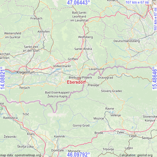
Ebersdorf GPS coordinates[2]
46° 34' 59.988" North, 14° 46' 59.988" East
| Map corner | latitude | longitude |
|---|---|---|
| Upper-left | 47.06443°, | 14.08021° |
| Center: | 46.58333°, | 14.78333° |
| Lower-right: | 46.09792°, | 15.48646° |
| Map W x H: | 107.5×107.5 km | = 66.8×66.8mi |
| max Lat: | 48.98333° ⇑99% North |
| Ebersdorf: | 46.58333° |
| min Lat: | ⇓1% South 46.48841° |
| min Long | Ebersdorf | max Long |
| 9.57802° | 14.78333° | 17.1° |
| W 51%⇐ | ⇒49% E |
Elevation
Elevation of Ebersdorf is 585 m = 1919 ft, and this is 79.5 m = 261 ft above average elevation for this country.
| Max E: |
2140 m = 7021 ft | 30.4% |
| Ebersdorf | 585 m 1919 ft | |
| Avg. | 505.5 m = 1658 ft | |
Min E: |
118 m = 387 ft | 69.6% |
See also: Austria elevation on elevation.city.
Geographical zone
Ebersdorf is located in North temperate zone (between Tropic of Cancer and the Arctic Circle). Distance of this North polar circle is 2221.6 km =1380.4 mi to North.| Distance of | km | miles | from Ebersdorf |
|---|---|---|---|
| North Pole | 4827.5 | 2999.7 | to North |
| Arctic Circle | 2221.6 | 1380.4 | to North |
| Tropic Cancer | 2573.7 | 1599.2 | to South |
| Equator | 5179.6 | 3218.5 | to South |


Nearby cities:
15 places around Ebersdorf: (largest is in red/bold)
• Bleiburg/Pliberk
1.4 km =0.9 mi,  58°
58°
• Eberndorf
10.7 km =6.6 mi,  274°
274°
• Feistritz ob Bleiburg
3.9 km =2.4 mi,  198°
198°
• Globasnitz
6.8 km =4.2 mi,  244°
244°
• Griffen
14 km =8.7 mi,  344°
344°
• Gösselsdorf
11.4 km =7.1 mi,  264°
264°
• Kühnsdorf
12 km =7.5 mi,  290°
290°
• Lavamünd
14 km =8.7 mi, 63°
• Mittlern
5.3 km =3.3 mi,  296°
296°
• Neuhaus
9.4 km =5.8 mi,  53°
53°
• Ruden
8.4 km =5.2 mi,  356°
356°
• Sankt Michael ob Bleiburg
3.1 km =1.9 mi, 260°
• Sittersdorf
14.2 km =8.8 mi,  252°
252°
• Völkermarkt
14.4 km =8.9 mi,  307°
307°
• Wasserhofen
13.3 km =8.3 mi, 286°
Sources, notices
• [Note1] Compared only with cities in Austria existing in our database
• [Src1] Map data: © OpenStreetMap contributors (CC-BY-SA)
• [Src2] Other city data from geonames.org with taken over terms of usage.
• [Src3] Geographical zone / Annual Mean Temperature by Robert A. Rohde @ Wikipedia
