Wasserhofen geodata
Wasserhofen (Carinthia) is a populated place; located in Austria in Europe/Vienna (GMT+2) time zone. With population of 582 people, there are 2203 cities with bigger population in this country. Compared to other cities in Austria, 98% of cities are located further ↑North; 51.5% of cities are located further →East and 50.8% of cities have higher elevation than Wasserhofen. Note1
Administrative division(s):
- Level 1: Carinthia
- Level 2: Politischer Bezirk Völkermarkt
- Level 3: Sankt Kanzian am Klopeiner See


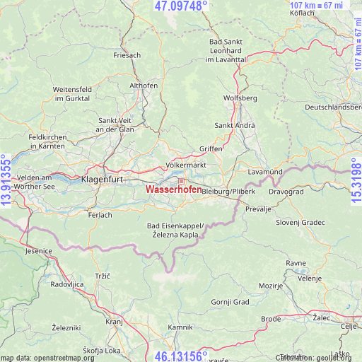
Wasserhofen GPS coordinates[2]
46° 37' 0.012" North, 14° 37' 0.012" East
| Map corner | latitude | longitude |
|---|---|---|
| Upper-left | 47.09748°, | 13.91355° |
| Center: | 46.61667°, | 14.61667° |
| Lower-right: | 46.13156°, | 15.3198° |
| Map W x H: | 107.4×107.4 km | = 66.7×66.7mi |
| max Lat: | 48.98333° ⇑98% North |
| Wasserhofen: | 46.61667° |
| min Lat: | ⇓2% South 46.48841° |
| min Long | Wasserhofen | max Long |
| 9.57802° | 14.61667° | 17.1° |
| W 48.5%⇐ | ⇒51.5% E |
Elevation
Elevation of Wasserhofen is 446 m = 1463 ft, and this is 59.5 m = 195 ft below average elevation for this country.
| Max E: |
2140 m = 7021 ft | 50.8% |
| Avg. | 505.5 m = 1658 ft | |
| Wasserhofen | 446 m = 1463 ft | |
Min E: |
118 m = 387 ft | 49.2% |
See also: Austria elevation on elevation.city.
Geographical zone
Wasserhofen is located in North temperate zone (between Tropic of Cancer and the Arctic Circle). Distance of this North polar circle is 2217.9 km =1378.1 mi to North.| Distance of | km | miles | from Wasserhofen |
|---|---|---|---|
| North Pole | 4823.8 | 2997.4 | to North |
| Arctic Circle | 2217.9 | 1378.1 | to North |
| Tropic Cancer | 2577.4 | 1601.5 | to South |
| Equator | 5183.3 | 3220.8 | to South |


Nearby cities:
15 places around Wasserhofen: (largest is in red/bold)
• Eberndorf
3.5 km =2.2 mi,  143°
143°
• Ebersdorf
13.3 km =8.3 mi,  106°
106°
• Gallizien
10.6 km =6.6 mi,  225°
225°
• Globasnitz
9.3 km =5.8 mi, 135°
• Grafenstein
11.4 km =7.1 mi,  268°
268°
• Griffen
13.2 km =8.2 mi,  42°
42°
• Gösselsdorf
5.1 km =3.2 mi,  163°
163°
• Kühnsdorf
1.6 km =1 mi,  68°
68°
• Leibsdorf
11.5 km =7.1 mi,  290°
290°
• Mittlern
8.1 km =5 mi,  99°
99°
• Ruden
13 km =8.1 mi, 69°
• Sankt Michael ob Bleiburg
10.5 km =6.5 mi, 113°
• Sittersdorf
8.1 km =5 mi,  185°
185°
• Tainach
6.6 km =4.1 mi, 286°
• Völkermarkt
5.2 km =3.2 mi,  14°
14°
Sources, notices
• [Note1] Compared only with cities in Austria existing in our database
• [Src1] Map data: © OpenStreetMap contributors (CC-BY-SA)
• [Src2] Other city data from geonames.org with taken over terms of usage.
• [Src3] Geographical zone / Annual Mean Temperature by Robert A. Rohde @ Wikipedia
