Hundsheim geodata
Hundsheim (Lower Austria) is a seat of a third-order administrative division; located in Austria in Europe/Vienna (GMT+2) time zone. With population of 590 people, there are 2168 cities with bigger population in this country. Compared to other cities in Austria, 73.7% of cities are located further ↓South; 99.4% of cities are located further ←West and 89.8% of cities have higher elevation than Hundsheim. Note1
Administrative division(s):
- Level 1: Lower Austria
- Level 2: Politischer Bezirk Bruck an der Leitha
- Level 3: Hundsheim


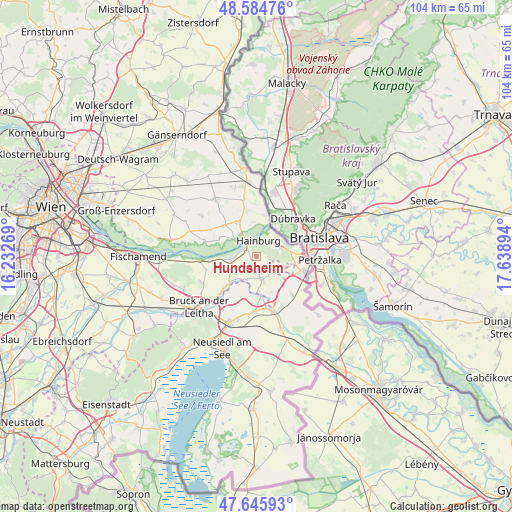
Hundsheim GPS coordinates[2]
48° 7' 2.964" North, 16° 56' 8.916" East
| Map corner | latitude | longitude |
|---|---|---|
| Upper-left | 48.58476°, | 16.23269° |
| Center: | 48.11749°, | 16.93581° |
| Lower-right: | 47.64593°, | 17.63894° |
| Map W x H: | 104.4×104.4 km | = 64.9×64.9mi |
| max Lat: | 48.98333° ⇑26.3% North |
| Hundsheim: | 48.11749° |
| min Lat: | ⇓73.7% South 46.48841° |
| min Long | Hundsheim | max Long |
| 9.57802° | 16.93581° | 17.1° |
| W 99.4%⇐ | ⇒0.59999999999999% E |
Elevation
Elevation of Hundsheim is 214 m = 702 ft, and this is 291.5 m = 956 ft below average elevation for this country.
| Max E: |
2140 m = 7021 ft | 89.8% |
| Avg. | 505.5 m = 1658 ft | |
| Hundsheim | 214 m = 702 ft | |
Min E: |
118 m = 387 ft | 10.2% |
See also: Austria elevation on elevation.city.
Geographical zone
Hundsheim is located in North temperate zone (between Tropic of Cancer and the Arctic Circle). Distance of this North polar circle is 2051 km =1274.4 mi to North.| Distance of | km | miles | from Hundsheim |
|---|---|---|---|
| North Pole | 4656.9 | 2893.7 | to North |
| Arctic Circle | 2051 | 1274.4 | to North |
| Tropic Cancer | 2744.2 | 1705.2 | to South |
| Equator | 5350.2 | 3324.5 | to South |


Nearby cities:
15 places around Hundsheim: (largest is in red/bold)
• Bad Deutsch-Altenburg
2.9 km =1.8 mi,  310°
310°
• Berg
7.8 km =4.8 mi,  103°
103°
• Eckartsau
10.7 km =6.6 mi,  286°
286°
• Edelstal
4 km =2.5 mi,  118°
118°
• Engelhartstetten
8.1 km =5 mi,  331°
331°
• Hainburg an der Donau
3.3 km =2.1 mi,  12°
12°
• Kittsee
9.9 km =6.2 mi,  106°
106°
• Neudorf bei Parndorf
11.2 km =7 mi,  180°
180°
• Pama
10.4 km =6.5 mi,  136°
136°
• Petronell-Carnuntum
5.2 km =3.2 mi,  264°
264°
• Potzneusiedl
8.1 km =5 mi,  173°
173°
• Prellenkirchen
5 km =3.1 mi, 165°
• Rohrau
8.5 km =5.3 mi,  228°
228°
• Scharndorf
10.5 km =6.5 mi, 255°
• Wolfsthal
5.1 km =3.2 mi,  69°
69°
Sources, notices
• [Note1] Compared only with cities in Austria existing in our database
• [Src1] Map data: © OpenStreetMap contributors (CC-BY-SA)
• [Src2] Other city data from geonames.org with taken over terms of usage.
• [Src3] Geographical zone / Annual Mean Temperature by Robert A. Rohde @ Wikipedia
