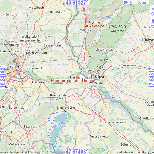
Hainburg an der Donau geodata
Hainburg an der Donau (Lower Austria) is a populated place; located in Austria in Europe/Vienna (GMT+2) time zone. With population of 6,570 people, there are 144 cities with bigger population in this country. Compared to other cities in Austria, 75.3% of cities are located further ↓South; 99.5% of cities are located further ←West and 96.1% of cities have higher elevation than Hainburg an der Donau. Note1
Administrative division(s):
- Level 1: Lower Austria
- Level 2: Politischer Bezirk Bruck an der Leitha
- Level 3: Hainburg a.d. Donau


Hainburg an der Donau GPS coordinates[2]
48° 8' 46.572" North, 16° 56' 42.144" East
| Map corner | latitude | longitude |
|---|---|---|
| Upper-left | 48.61327°, | 16.24192° |
| Center: | 48.14627°, | 16.94504° |
| Lower-right: | 47.67498°, | 17.64817° |
| Map W x H: | 104.3×104.3 km | = 64.8×64.8mi |
| max Lat: | 48.98333° ⇑24.7% North |
| Hainburg an der Donau: | 48.14627° |
| min Lat: | ⇓75.3% South 46.48841° |
| min Long | Hainburg an der | max Long |
| 9.57802° | 16.94504° | 17.1° |
| W 99.5%⇐ | ⇒0.5% E |
Elevation
Elevation of Hainburg an der Donau is 170 m = 558 ft, and this is 335.5 m = 1101 ft below average elevation for this country.
| Max E: |
2140 m = 7021 ft | 96.1% |
| Avg. | 505.5 m = 1658 ft | |
| Hainburg an der Donau | 170 m = 558 ft | |
Min E: |
118 m = 387 ft | 3.9% |
See also: Austria elevation on elevation.city.
Geographical zone
Hainburg an der Donau is located in North temperate zone (between Tropic of Cancer and the Arctic Circle). Distance of this North polar circle is 2047.8 km =1272.4 mi to North.| Distance of | km | miles | from Hainburg an der Donau |
|---|---|---|---|
| North Pole | 4653.7 | 2891.7 | to North |
| Arctic Circle | 2047.8 | 1272.4 | to North |
| Tropic Cancer | 2747.4 | 1707.2 | to South |
| Equator | 5353.4 | 3326.4 | to South |


Nearby cities:
15 places around Hainburg an der Donau: (largest is in red/bold)
• Bad Deutsch-Altenburg
3.2 km =2 mi,  245°
245°
• Berg
8.5 km =5.3 mi,  125°
125°
• Breitensee
11.9 km =7.4 mi,  335°
335°
• Eckartsau
11 km =6.8 mi,  269°
269°
• Edelstal
5.9 km =3.7 mi,  151°
151°
• Engelhartstetten
6 km =3.7 mi,  310°
310°
• Hundsheim
3.3 km =2.1 mi,  192°
192°
• Kittsee
10.7 km =6.6 mi,  124°
124°
• Pama
12.6 km =7.8 mi, 148°
• Petronell-Carnuntum
6.9 km =4.3 mi,  237°
237°
• Potzneusiedl
11.3 km =7 mi,  178°
178°
• Prellenkirchen
8.1 km =5 mi, 176°
• Rohrau
11.3 km =7 mi,  218°
218°
• Scharndorf
12.3 km =7.6 mi, 241°
• Wolfsthal
4.3 km =2.7 mi,  109°
109°
Sources, notices
• [Note1] Compared only with cities in Austria existing in our database
• [Src1] Map data: © OpenStreetMap contributors (CC-BY-SA)
• [Src2] Other city data from geonames.org with taken over terms of usage.
• [Src3] Geographical zone / Annual Mean Temperature by Robert A. Rohde @ Wikipedia
