Engelhartstetten geodata
Engelhartstetten (Lower Austria) is a seat of a third-order administrative division; located in Austria in Europe/Vienna (GMT+2) time zone. With population of 907 people, there are 1417 cities with bigger population in this country. Compared to other cities in Austria, 77.7% of cities are located further ↓South; 99.1% of cities are located further ←West and 99% of cities have higher elevation than Engelhartstetten. Note1
Administrative division(s):
- Level 1: Lower Austria
- Level 2: Politischer Bezirk Gänserndorf
- Level 3: Engelhartstetten


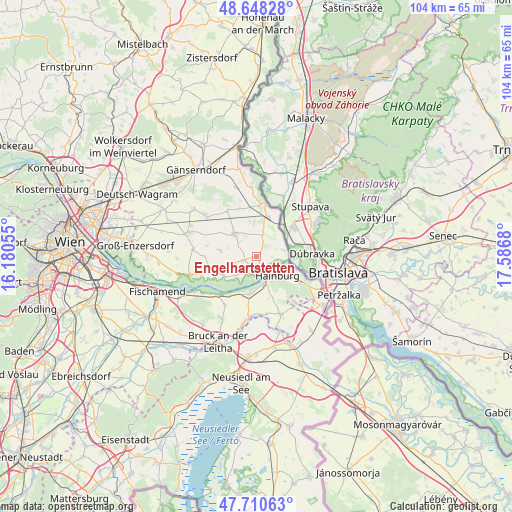
Engelhartstetten GPS coordinates[2]
48° 10' 53.76" North, 16° 53' 1.212" East
| Map corner | latitude | longitude |
|---|---|---|
| Upper-left | 48.64828°, | 16.18055° |
| Center: | 48.1816°, | 16.88367° |
| Lower-right: | 47.71063°, | 17.5868° |
| Map W x H: | 104.3×104.3 km | = 64.8×64.8mi |
| max Lat: | 48.98333° ⇑22.3% North |
| Engelhartstetten: | 48.1816° |
| min Lat: | ⇓77.7% South 46.48841° |
| min Long | Engelhartstette | max Long |
| 9.57802° | 16.88367° | 17.1° |
| W 99.1%⇐ | ⇒0.90000000000001% E |
Elevation
Elevation of Engelhartstetten is 143 m = 469 ft, and this is 362.5 m = 1189 ft below average elevation for this country.
| Max E: |
2140 m = 7021 ft | 99% |
| Avg. | 505.5 m = 1658 ft | |
| Engelhartstetten | 143 m = 469 ft | |
Min E: |
118 m = 387 ft | 1% |
See also: Austria elevation on elevation.city.
Geographical zone
Engelhartstetten is located in North temperate zone (between Tropic of Cancer and the Arctic Circle). Distance of this North polar circle is 2043.9 km =1270 mi to North.| Distance of | km | miles | from Engelhartstetten |
|---|---|---|---|
| North Pole | 4649.8 | 2889.3 | to North |
| Arctic Circle | 2043.9 | 1270 | to North |
| Tropic Cancer | 2751.4 | 1709.6 | to South |
| Equator | 5357.3 | 3328.9 | to South |


Nearby cities:
15 places around Engelhartstetten: (largest is in red/bold)
• Bad Deutsch-Altenburg
5.5 km =3.4 mi,  162°
162°
• Breitensee
7 km =4.3 mi,  357°
357°
• Eckartsau
7.6 km =4.7 mi,  237°
237°
• Edelstal
11.7 km =7.3 mi,  140°
140°
• Hainburg an der Donau
6 km =3.7 mi,  130°
130°
• Haringsee
7.2 km =4.5 mi,  279°
279°
• Hundsheim
8.1 km =5 mi,  151°
151°
• Lassee
6.6 km =4.1 mi,  316°
316°
• Marchegg
9.2 km =5.7 mi,  12°
12°
• Petronell-Carnuntum
7.7 km =4.8 mi,  189°
189°
• Prellenkirchen
13 km =8.1 mi, 156°
• Rohrau
13 km =8.1 mi, 191°
• Scharndorf
11.6 km =7.2 mi,  212°
212°
• Untersiebenbrunn
13.5 km =8.4 mi,  304°
304°
• Wolfsthal
10.2 km =6.3 mi,  121°
121°
Sources, notices
• [Note1] Compared only with cities in Austria existing in our database
• [Src1] Map data: © OpenStreetMap contributors (CC-BY-SA)
• [Src2] Other city data from geonames.org with taken over terms of usage.
• [Src3] Geographical zone / Annual Mean Temperature by Robert A. Rohde @ Wikipedia
