Hopfgarten in Defereggen geodata
Hopfgarten in Defereggen (Tyrol) is a seat of a third-order administrative division; located in Austria in Europe/Vienna (GMT+2) time zone. With population of 249 people, there are 2811 cities with bigger population in this country. Compared to other cities in Austria, 87.5% of cities are located further ↑North; 85.9% of cities are located further →East and 98.9% of cities have lower elevation than Hopfgarten in Defereggen. Note1
Administrative division(s):
- Level 1: Tyrol
- Level 2: Politischer Bezirk Lienz
- Level 3: Hopfgarten in Defereggen
Current local time in Hopfgarten in Defereggen:
01:21 AM, SaturdayDifference from your time zone: hours


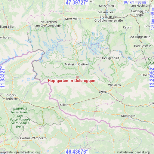
Hopfgarten in Defereggen GPS coordinates[2]
46° 55' 9.012" North, 12° 32' 11.004" East
| Map corner | latitude | longitude |
|---|---|---|
| Upper-left | 47.39727°, | 11.83327° |
| Center: | 46.91917°, | 12.53639° |
| Lower-right: | 46.43676°, | 13.23952° |
| Map W x H: | 106.8×106.8 km | = 66.4×66.4mi |
| max Lat: | 48.98333° ⇑87.5% North |
| Hopfgarten in Defereggen: | 46.91917° |
| min Lat: | ⇓12.5% South 46.48841° |
| min Long | Hopfgarten in D | max Long |
| 9.57802° | 12.53639° | 17.1° |
| W 14.1%⇐ | ⇒85.9% E |
Elevation
Elevation of Hopfgarten in Defereggen is 1318 m = 4324 ft, and this is 812.5 m = 2666 ft above average elevation for this country.
| Max E: |
2140 m = 7021 ft | 1.1% |
| Hopfgarten in Defereggen | 1318 m 4324 ft | |
| Avg. | 505.5 m = 1658 ft | |
Min E: |
118 m = 387 ft | 98.9% |
See also: Austria elevation on elevation.city.
Geographical zone
Hopfgarten in Defereggen is located in North temperate zone (between Tropic of Cancer and the Arctic Circle). Distance of this North polar circle is 2184.3 km =1357.3 mi to North.| Distance of | km | miles | from Hopfgarten in Defereggen |
|---|---|---|---|
| North Pole | 4790.1 | 2976.4 | to North |
| Arctic Circle | 2184.3 | 1357.3 | to North |
| Tropic Cancer | 2611 | 1622.4 | to South |
| Equator | 5216.9 | 3241.6 | to South |


Nearby cities:
15 places around Hopfgarten in Defereggen: (largest is in red/bold)
• Abfaltersbach
18 km =11.2 mi,  181°
181°
• Ainet
13.1 km =8.1 mi,  116°
116°
• Anras
16.3 km =10.1 mi,  173°
173°
• Assling
16.7 km =10.4 mi,  151°
151°
• Außervillgraten
16.7 km =10.4 mi,  208°
208°
• Innervillgraten
17.1 km =10.6 mi,  225°
225°
• Kals am Großglockner
12.4 km =7.7 mi,  41°
41°
• Matrei in Osttirol
9 km =5.6 mi,  358°
358°
• Oberlienz
16.8 km =10.4 mi, 118°
• Prägraten
15.9 km =9.9 mi,  313°
313°
• Sankt Andrä
16.5 km =10.3 mi, 311°
• Sankt Jakob in Defereggen
15.6 km =9.7 mi,  270°
270°
• Sankt Veit in Defereggen
8.1 km =5 mi,  276°
276°
• Schlaiten
10 km =6.2 mi, 116°
• Virgen
11 km =6.8 mi,  326°
326°
Sources, notices
• [Note1] Compared only with cities in Austria existing in our database
• [Src1] Map data: © OpenStreetMap contributors (CC-BY-SA)
• [Src2] Other city data from geonames.org with taken over terms of usage.
• [Src3] Geographical zone / Annual Mean Temperature by Robert A. Rohde @ Wikipedia
