Hohenau geodata
Hohenau (Lower Austria) is a populated place; located in Austria in Europe/Vienna (GMT+2) time zone. With population of 2,738 people, there are 425 cities with bigger population in this country. Compared to other cities in Austria, 96.8% of cities are located further ↓South; 99.2% of cities are located further ←West and 98.2% of cities have higher elevation than Hohenau. Note1
Administrative division(s):
- Level 1: Lower Austria
- Level 2: Politischer Bezirk Gänserndorf
- Level 3: Hohenau an der March


Hohenau GPS coordinates[2]
48° 36' 15.12" North, 16° 54' 16.92" East
| Map corner | latitude | longitude |
|---|---|---|
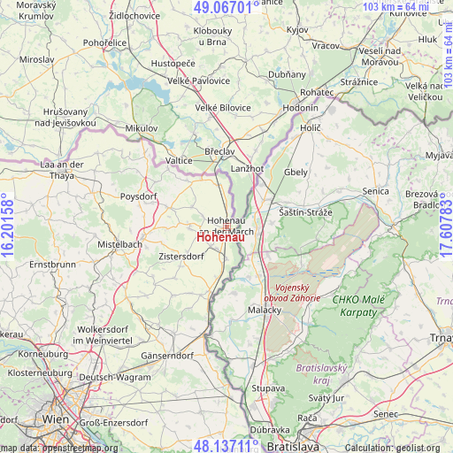
| Upper-left | 49.06701°, | 16.20158° |
| Center: | 48.6042°, | 16.9047° |
| Lower-right: | 48.13711°, | 17.60783° |
| Map W x H: | 103.4×103.4 km | = 64.2×64.2mi |
| max Lat: | 48.98333° ⇑3.2% North |
| Hohenau: | 48.6042° |
| min Lat: | ⇓96.8% South 46.48841° |
| min Long | Hohenau | max Long |
| 9.57802° | 16.9047° | 17.1° |
| W 99.2%⇐ | ⇒0.8% E |
Elevation
Elevation of Hohenau is 152 m = 499 ft, and this is 353.5 m = 1160 ft below average elevation for this country.
| Max E: |
2140 m = 7021 ft | 98.2% |
| Avg. | 505.5 m = 1658 ft | |
| Hohenau | 152 m = 499 ft | |
Min E: |
118 m = 387 ft | 1.8% |
See also: Austria elevation on elevation.city.
Geographical zone
Hohenau is located in North temperate zone (between Tropic of Cancer and the Arctic Circle). Distance of this North polar circle is 1996.9 km =1240.8 mi to North.| Distance of | km | miles | from Hohenau |
|---|---|---|---|
| North Pole | 4602.8 | 2860 | to North |
| Arctic Circle | 1996.9 | 1240.8 | to North |
| Tropic Cancer | 2798.4 | 1738.8 | to South |
| Equator | 5404.3 | 3358.1 | to South |


Nearby cities:
15 places around Hohenau: (largest is in red/bold)
• Altlichtenwarth
9.1 km =5.7 mi,  299°
299°
• Bernhardsthal
10.1 km =6.3 mi,  345°
345°
• Dobermannsdorf
6.5 km =4 mi,  265°
265°
• Drösing
7.3 km =4.5 mi,  181°
181°
• Groß-Inzersdorf
13.7 km =8.5 mi,  230°
230°
• Großkrut
14 km =8.7 mi,  288°
288°
• Hausbrunn
6.1 km =3.8 mi, 293°
• Hauskirchen
10.2 km =6.3 mi, 267°
• Jedenspeigen
12 km =7.5 mi,  191°
191°
• Neusiedl an der Zaya
9.2 km =5.7 mi, 266°
• Niederabsdorf
5.8 km =3.6 mi,  223°
223°
• Palterndorf
6.9 km =4.3 mi,  250°
250°
• Rabensburg
5.1 km =3.2 mi,  356°
356°
• Ringelsdorf
5 km =3.1 mi,  213°
213°
• Zistersdorf
12.6 km =7.8 mi,  236°
236°
Sources, notices
• [Note1] Compared only with cities in Austria existing in our database
• [Src1] Map data: © OpenStreetMap contributors (CC-BY-SA)
• [Src2] Other city data from geonames.org with taken over terms of usage.
• [Src3] Geographical zone / Annual Mean Temperature by Robert A. Rohde @ Wikipedia
