Heiterwang geodata
Heiterwang (Tyrol) is a seat of a third-order administrative division; located in Austria in Europe/Vienna (GMT+2) time zone. With population of 532 people, there are 2388 cities with bigger population in this country. Compared to other cities in Austria, 56.5% of cities are located further ↑North; 94.5% of cities are located further →East and 93.9% of cities have lower elevation than Heiterwang. Note1


Heiterwang GPS coordinates[2]
47° 27' 0" North, 10° 45' 0" East
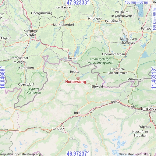
| Map corner | latitude | longitude |
|---|---|---|
| Upper-left | 47.92333°, | 10.04688° |
| Center: | 47.45°, | 10.75° |
| Lower-right: | 46.97237°, | 11.45313° |
| Map W x H: | 105.7×105.7 km | = 65.7×65.7mi |
| max Lat: | 48.98333° ⇑56.5% North |
| Heiterwang: | 47.45° |
| min Lat: | ⇓43.5% South 46.48841° |
| min Long | Heiterwang | max Long |
| 9.57802° | 10.75° | 17.1° |
| W 5.5%⇐ | ⇒94.5% E |
Elevation
Elevation of Heiterwang is 980 m = 3215 ft, and this is 474.5 m = 1557 ft above average elevation for this country.
| Max E: |
2140 m = 7021 ft | 6.1% |
| Heiterwang | 980 m 3215 ft | |
| Avg. | 505.5 m = 1658 ft | |
Min E: |
118 m = 387 ft | 93.9% |
See also: Austria elevation on elevation.city.
Geographical zone
Heiterwang is located in North temperate zone (between Tropic of Cancer and the Arctic Circle). Distance of this North polar circle is 2125.2 km =1320.5 mi to North.| Distance of | km | miles | from Heiterwang |
|---|---|---|---|
| North Pole | 4731.1 | 2939.8 | to North |
| Arctic Circle | 2125.2 | 1320.5 | to North |
| Tropic Cancer | 2670 | 1659.1 | to South |
| Equator | 5275.9 | 3278.3 | to South |


Nearby cities:
15 places around Heiterwang: (largest is in red/bold)
• Berwang
4.7 km =2.9 mi,  182°
182°
• Bichlbach
4.5 km =2.8 mi,  137°
137°
• Breitenwang
4.3 km =2.7 mi,  343°
343°
• Ehenbichl
4.2 km =2.6 mi,  296°
296°
• Forchach
13.1 km =8.1 mi,  253°
253°
• Höfen
5.3 km =3.3 mi,  290°
290°
• Lechaschau
5.3 km =3.3 mi,  322°
322°
• Lermoos
11.1 km =6.9 mi,  117°
117°
• Musau
10.8 km =6.7 mi,  327°
327°
• Namlos
12.8 km =8 mi,  209°
209°
• Nesselwängle
10.7 km =6.6 mi, 290°
• Pflach
7.8 km =4.8 mi, 341°
• Reutte
4.5 km =2.8 mi, 325°
• Weissenbach am Lech
8.3 km =5.2 mi,  263°
263°
• Wängle
6.1 km =3.8 mi,  312°
312°
Sources, notices
• [Note1] Compared only with cities in Austria existing in our database
• [Src1] Map data: © OpenStreetMap contributors (CC-BY-SA)
• [Src2] Other city data from geonames.org with taken over terms of usage.
• [Src3] Geographical zone / Annual Mean Temperature by Robert A. Rohde @ Wikipedia
