Musau geodata
Musau (Tyrol) is a seat of a third-order administrative division; located in Austria in Europe/Vienna (GMT+2) time zone. With population of 391 people, there are 2627 cities with bigger population in this country. Compared to other cities in Austria, 52.4% of cities are located further ↑North; 95.1% of cities are located further →East and 86.6% of cities have lower elevation than Musau. Note1


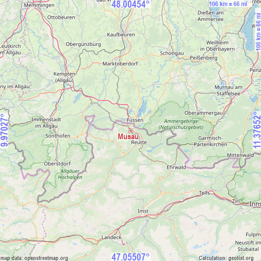
Musau GPS coordinates[2]
47° 31' 55.02" North, 10° 40' 24.204" East
| Map corner | latitude | longitude |
|---|---|---|
| Upper-left | 48.00454°, | 9.97027° |
| Center: | 47.53195°, | 10.67339° |
| Lower-right: | 47.05507°, | 11.37652° |
| Map W x H: | 105.6×105.6 km | = 65.6×65.6mi |
| max Lat: | 48.98333° ⇑52.4% North |
| Musau: | 47.53195° |
| min Lat: | ⇓47.6% South 46.48841° |
| min Long | Musau | max Long |
| 9.57802° | 10.67339° | 17.1° |
| W 4.9%⇐ | ⇒95.1% E |
Elevation
Elevation of Musau is 821 m = 2694 ft, and this is 315.5 m = 1035 ft above average elevation for this country.
| Max E: |
2140 m = 7021 ft | 13.4% |
| Musau | 821 m 2694 ft | |
| Avg. | 505.5 m = 1658 ft | |
Min E: |
118 m = 387 ft | 86.6% |
See also: Austria elevation on elevation.city.
Geographical zone
Musau is located in North temperate zone (between Tropic of Cancer and the Arctic Circle). Distance of this North polar circle is 2116.1 km =1314.9 mi to North.| Distance of | km | miles | from Musau |
|---|---|---|---|
| North Pole | 4722 | 2934.1 | to North |
| Arctic Circle | 2116.1 | 1314.9 | to North |
| Tropic Cancer | 2679.1 | 1664.7 | to South |
| Equator | 5285.1 | 3284 | to South |


Nearby cities:
15 places around Musau: (largest is in red/bold)
• Breitenwang
6.8 km =4.2 mi,  137°
137°
• Ehenbichl
7.5 km =4.7 mi,  164°
164°
• Forchach
14.5 km =9 mi,  207°
207°
• Grän
9.9 km =6.2 mi,  249°
249°
• Heiterwang
10.8 km =6.7 mi,  147°
147°
• Höfen
7.3 km =4.5 mi,  174°
174°
• Lechaschau
5.5 km =3.4 mi, 152°
• Nesselwängle
6.9 km =4.3 mi,  218°
218°
• Pflach
3.7 km =2.3 mi,  117°
117°
• Reutte
6.3 km =3.9 mi, 148°
• Tannheim
12.3 km =7.6 mi, 252°
• Vils
3.6 km =2.2 mi,  303°
303°
• Weissenbach am Lech
10.3 km =6.4 mi,  193°
193°
• Wängle
5.2 km =3.2 mi, 166°
• Zöblen
14.8 km =9.2 mi,  259°
259°
Sources, notices
• [Note1] Compared only with cities in Austria existing in our database
• [Src1] Map data: © OpenStreetMap contributors (CC-BY-SA)
• [Src2] Other city data from geonames.org with taken over terms of usage.
• [Src3] Geographical zone / Annual Mean Temperature by Robert A. Rohde @ Wikipedia
