Hausmening geodata
Hausmening (Lower Austria) is a populated place; located in Austria in Europe/Vienna (GMT+2) time zone. With population of 2,043 people, there are 600 cities with bigger population in this country. Compared to other cities in Austria, 70.8% of cities are located further ↓South; 51.7% of cities are located further ←West and 75% of cities have higher elevation than Hausmening. Note1
Administrative division(s):
- Level 1: Lower Austria
- Level 2: Politischer Bezirk Amstetten
- Level 3: Amstetten


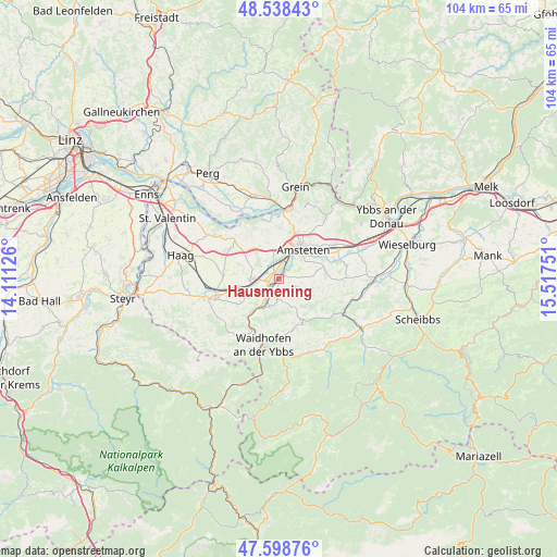
Hausmening GPS coordinates[2]
48° 4' 14.664" North, 14° 48' 51.768" East
| Map corner | latitude | longitude |
|---|---|---|
| Upper-left | 48.53843°, | 14.11126° |
| Center: | 48.07074°, | 14.81438° |
| Lower-right: | 47.59876°, | 15.51751° |
| Map W x H: | 104.5×104.5 km | = 64.9×64.9mi |
| max Lat: | 48.98333° ⇑29.2% North |
| Hausmening: | 48.07074° |
| min Lat: | ⇓70.8% South 46.48841° |
| min Long | Hausmening | max Long |
| 9.57802° | 14.81438° | 17.1° |
| W 51.7%⇐ | ⇒48.3% E |
Elevation
Elevation of Hausmening is 303 m = 994 ft, and this is 202.5 m = 664 ft below average elevation for this country.
| Max E: |
2140 m = 7021 ft | 75% |
| Avg. | 505.5 m = 1658 ft | |
| Hausmening | 303 m = 994 ft | |
Min E: |
118 m = 387 ft | 25% |
See also: Austria elevation on elevation.city.
Geographical zone
Hausmening is located in North temperate zone (between Tropic of Cancer and the Arctic Circle). Distance of this North polar circle is 2056.2 km =1277.7 mi to North.| Distance of | km | miles | from Hausmening |
|---|---|---|---|
| North Pole | 4662.1 | 2896.9 | to North |
| Arctic Circle | 2056.2 | 1277.7 | to North |
| Tropic Cancer | 2739 | 1701.9 | to South |
| Equator | 5345 | 3321.2 | to South |


Nearby cities:
15 places around Hausmening: (largest is in red/bold)
• Allhartsberg
5.3 km =3.3 mi,  200°
200°
• Amstetten
7.2 km =4.5 mi,  36°
36°
• Aschbach Markt
4.5 km =2.8 mi,  272°
272°
• Euratsfeld
8.8 km =5.5 mi,  81°
81°
• Greinsfurth
4.7 km =2.9 mi,  27°
27°
• Kematen an der Ybbs
6.2 km =3.9 mi,  216°
216°
• Mauer bei Amstetten
3 km =1.9 mi,  340°
340°
• Mitterhausleiten
6.9 km =4.3 mi,  277°
277°
• Neufurth
0.9 km =0.6 mi,  348°
348°
• Neuhofen an der Ybbs
3.3 km =2.1 mi,  115°
115°
• Oehling
3.4 km =2.1 mi, 341°
• Stephanshart
8.8 km =5.5 mi,  1°
1°
• Ulmerfeld
0.7 km =0.4 mi, 26°
• Winklarn
3.4 km =2.1 mi,  47°
47°
• Zeillern
6.6 km =4.1 mi,  355°
355°
Sources, notices
• [Note1] Compared only with cities in Austria existing in our database
• [Src1] Map data: © OpenStreetMap contributors (CC-BY-SA)
• [Src2] Other city data from geonames.org with taken over terms of usage.
• [Src3] Geographical zone / Annual Mean Temperature by Robert A. Rohde @ Wikipedia
