Hausmannstätten geodata
Hausmannstätten (Styria) is a seat of a third-order administrative division; located in Austria in Europe/Vienna (GMT+2) time zone. With population of 2,934 people, there are 394 cities with bigger population in this country. Compared to other cities in Austria, 84.7% of cities are located further ↑North; 65.8% of cities are located further ←West and 66.2% of cities have higher elevation than Hausmannstätten. Note1
Administrative division(s):
- Level 1: Styria
- Level 2: Politischer Bezirk Graz-Umgebung
- Level 3: Hausmannstätten


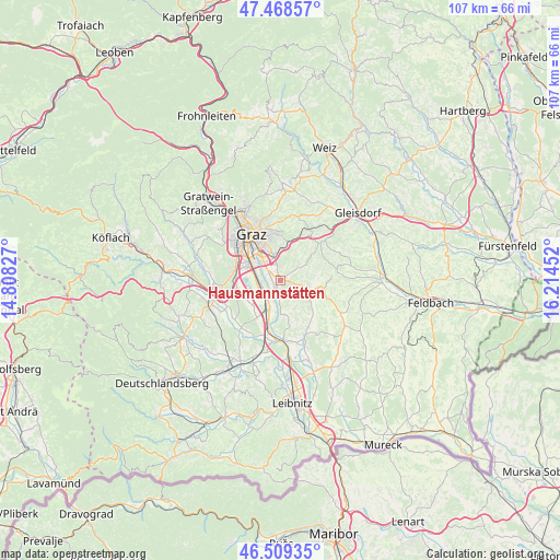
Hausmannstätten GPS coordinates[2]
46° 59' 27.996" North, 15° 30' 41.004" East
| Map corner | latitude | longitude |
|---|---|---|
| Upper-left | 47.46857°, | 14.80827° |
| Center: | 46.99111°, | 15.51139° |
| Lower-right: | 46.50935°, | 16.21452° |
| Map W x H: | 106.7×106.7 km | = 66.3×66.3mi |
| max Lat: | 48.98333° ⇑84.7% North |
| Hausmannstätten: | 46.99111° |
| min Lat: | ⇓15.3% South 46.48841° |
| min Long | Hausmannstätte | max Long |
| 9.57802° | 15.51139° | 17.1° |
| W 65.8%⇐ | ⇒34.2% E |
Elevation
Elevation of Hausmannstätten is 346 m = 1135 ft, and this is 159.5 m = 523 ft below average elevation for this country.
| Max E: |
2140 m = 7021 ft | 66.2% |
| Avg. | 505.5 m = 1658 ft | |
| Hausmannstätten | 346 m = 1135 ft | |
Min E: |
118 m = 387 ft | 33.8% |
See also: Austria elevation on elevation.city.
Geographical zone
Hausmannstätten is located in North temperate zone (between Tropic of Cancer and the Arctic Circle). Distance of this North polar circle is 2176.3 km =1352.3 mi to North.| Distance of | km | miles | from Hausmannstätten |
|---|---|---|---|
| North Pole | 4782.1 | 2971.5 | to North |
| Arctic Circle | 2176.3 | 1352.3 | to North |
| Tropic Cancer | 2619 | 1627.4 | to South |
| Equator | 5224.9 | 3246.6 | to South |


Nearby cities:
15 places around Hausmannstätten: (largest is in red/bold)
• Abtissendorf
4.2 km =2.6 mi,  277°
277°
• Dörfla
3.5 km =2.2 mi,  286°
286°
• Feldkirchen bei Graz
5.5 km =3.4 mi,  301°
301°
• Fernitz
2.1 km =1.3 mi,  202°
202°
• Grambach
2.7 km =1.7 mi,  348°
348°
• Grosssulz
5.3 km =3.3 mi, 197°
• Gössendorf
2.1 km =1.3 mi, 292°
• Hart bei Graz
5.8 km =3.6 mi,  2°
2°
• Kalsdorf bei Graz
3.7 km =2.3 mi,  219°
219°
• Lebern
4.8 km =3 mi, 281°
• Liebensdorf
4.4 km =2.7 mi,  103°
103°
• Raaba
4.8 km =3 mi, 349°
• Thondorf
3.5 km =2.2 mi,  308°
308°
• Vasoldsberg
4.5 km =2.8 mi,  51°
51°
• Wagnitz
3.5 km =2.2 mi,  255°
255°
Sources, notices
• [Note1] Compared only with cities in Austria existing in our database
• [Src1] Map data: © OpenStreetMap contributors (CC-BY-SA)
• [Src2] Other city data from geonames.org with taken over terms of usage.
• [Src3] Geographical zone / Annual Mean Temperature by Robert A. Rohde @ Wikipedia
