Gössendorf geodata
Gössendorf (Styria) is a seat of a third-order administrative division; located in Austria in Europe/Vienna (GMT+2) time zone. With population of 2,539 people, there are 470 cities with bigger population in this country. Compared to other cities in Austria, 84.4% of cities are located further ↑North; 65.1% of cities are located further ←West and 69.4% of cities have higher elevation than Gössendorf. Note1
Administrative division(s):
- Level 1: Styria
- Level 2: Politischer Bezirk Graz-Umgebung
- Level 3: Gössendorf


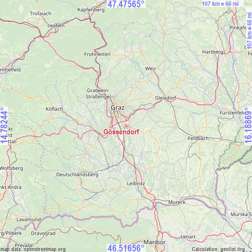
Gössendorf GPS coordinates[2]
46° 59' 53.736" North, 15° 29' 8.016" East
| Map corner | latitude | longitude |
|---|---|---|
| Upper-left | 47.47565°, | 14.78244° |
| Center: | 46.99826°, | 15.48556° |
| Lower-right: | 46.51656°, | 16.18869° |
| Map W x H: | 106.6×106.6 km | = 66.2×66.2mi |
| max Lat: | 48.98333° ⇑84.4% North |
| Gössendorf: | 46.99826° |
| min Lat: | ⇓15.6% South 46.48841° |
| min Long | Gössendorf | max Long |
| 9.57802° | 15.48556° | 17.1° |
| W 65.1%⇐ | ⇒34.9% E |
Elevation
Elevation of Gössendorf is 332 m = 1089 ft, and this is 173.5 m = 569 ft below average elevation for this country.
| Max E: |
2140 m = 7021 ft | 69.4% |
| Avg. | 505.5 m = 1658 ft | |
| Gössendorf | 332 m = 1089 ft | |
Min E: |
118 m = 387 ft | 30.6% |
See also: Austria elevation on elevation.city.
Geographical zone
Gössendorf is located in North temperate zone (between Tropic of Cancer and the Arctic Circle). Distance of this North polar circle is 2175.5 km =1351.8 mi to North.| Distance of | km | miles | from Gössendorf |
|---|---|---|---|
| North Pole | 4781.3 | 2971 | to North |
| Arctic Circle | 2175.5 | 1351.8 | to North |
| Tropic Cancer | 2619.8 | 1627.9 | to South |
| Equator | 5225.7 | 3247.1 | to South |


Nearby cities:
15 places around Gössendorf: (largest is in red/bold)
• Abtissendorf
2.2 km =1.4 mi,  263°
263°
• Dörfla
1.4 km =0.9 mi,  277°
277°
• Feldkirchen bei Graz
3.4 km =2.1 mi,  307°
307°
• Fernitz
3 km =1.9 mi,  156°
156°
• Grambach
2.3 km =1.4 mi,  37°
37°
• Hart bei Graz
5.5 km =3.4 mi,  24°
24°
• Hausmannstätten
2.1 km =1.3 mi,  112°
112°
• Kalsdorf bei Graz
3.7 km =2.3 mi,  186°
186°
• Lebern
2.7 km =1.7 mi,  274°
274°
• Liebenau
4.2 km =2.6 mi,  339°
339°
• Puntigam
5.6 km =3.5 mi, 314°
• Raaba
4.1 km =2.5 mi, 15°
• Thondorf
1.6 km =1 mi,  331°
331°
• Vasoldsberg
5.9 km =3.7 mi,  69°
69°
• Wagnitz
2.2 km =1.4 mi,  220°
220°
Sources, notices
• [Note1] Compared only with cities in Austria existing in our database
• [Src1] Map data: © OpenStreetMap contributors (CC-BY-SA)
• [Src2] Other city data from geonames.org with taken over terms of usage.
• [Src3] Geographical zone / Annual Mean Temperature by Robert A. Rohde @ Wikipedia
