Halbenrain geodata
Halbenrain (Styria) is a seat of a third-order administrative division; located in Austria in Europe/Vienna (GMT+2) time zone. With population of 598 people, there are 2149 cities with bigger population in this country. Compared to other cities in Austria, 94.6% of cities are located further ↑North; 78.7% of cities are located further ←West and 88.9% of cities have higher elevation than Halbenrain. Note1
Administrative division(s):
- Level 1: Styria
- Level 2: Politischer Bezirk Südoststeiermark
- Level 3: Halbenrain


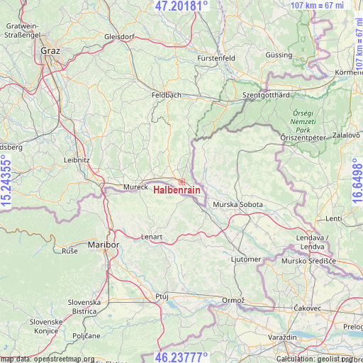
Halbenrain GPS coordinates[2]
46° 43' 18.984" North, 15° 56' 48.012" East
| Map corner | latitude | longitude |
|---|---|---|
| Upper-left | 47.20181°, | 15.24355° |
| Center: | 46.72194°, | 15.94667° |
| Lower-right: | 46.23777°, | 16.6498° |
| Map W x H: | 107.2×107.2 km | = 66.6×66.6mi |
| max Lat: | 48.98333° ⇑94.6% North |
| Halbenrain: | 46.72194° |
| min Lat: | ⇓5.4% South 46.48841° |
| min Long | Halbenrain | max Long |
| 9.57802° | 15.94667° | 17.1° |
| W 78.7%⇐ | ⇒21.3% E |
Elevation
Elevation of Halbenrain is 222 m = 728 ft, and this is 283.5 m = 930 ft below average elevation for this country.
| Max E: |
2140 m = 7021 ft | 88.9% |
| Avg. | 505.5 m = 1658 ft | |
| Halbenrain | 222 m = 728 ft | |
Min E: |
118 m = 387 ft | 11.1% |
See also: Austria elevation on elevation.city.
Geographical zone
Halbenrain is located in North temperate zone (between Tropic of Cancer and the Arctic Circle). Distance of this North polar circle is 2206.2 km =1370.9 mi to North.| Distance of | km | miles | from Halbenrain |
|---|---|---|---|
| North Pole | 4812.1 | 2990.1 | to North |
| Arctic Circle | 2206.2 | 1370.9 | to North |
| Tropic Cancer | 2589.1 | 1608.8 | to South |
| Equator | 5195 | 3228 | to South |


Nearby cities:
15 places around Halbenrain: (largest is in red/bold)
• Altneudörfl
3.2 km =2 mi,  140°
140°
• Bad Radkersburg
4.9 km =3 mi, 140°
• Deutsch Goritz
9.5 km =5.9 mi,  289°
289°
• Dietersdorf am Gnasbach
14.1 km =8.8 mi,  313°
313°
• Eichfeld
13.6 km =8.5 mi,  271°
271°
• Gosdorf
11.8 km =7.3 mi, 273°
• Hof bei Straden
8.7 km =5.4 mi,  353°
353°
• Klöch
5 km =3.1 mi,  16°
16°
• Mureck
13.2 km =8.2 mi,  263°
263°
• Ratschendorf
10.2 km =6.3 mi,  282°
282°
• Sankt Anna am Aigen
12.3 km =7.6 mi,  8°
8°
• Stainz bei Straden
12.1 km =7.5 mi,  340°
340°
• Straden
11.4 km =7.1 mi,  328°
328°
• Tieschen
7.1 km =4.4 mi,  357°
357°
• Trössing
14.5 km =9 mi,  316°
316°
Sources, notices
• [Note1] Compared only with cities in Austria existing in our database
• [Src1] Map data: © OpenStreetMap contributors (CC-BY-SA)
• [Src2] Other city data from geonames.org with taken over terms of usage.
• [Src3] Geographical zone / Annual Mean Temperature by Robert A. Rohde @ Wikipedia
