Großvassach geodata
Großvassach (Carinthia) is a populated place; located in Austria in Europe/Vienna (GMT+2) time zone. With population of 936 people, there are 1375 cities with bigger population in this country. Compared to other cities in Austria, 97.2% of cities are located further ↑North; 68% of cities are located further →East and 61.9% of cities have lower elevation than Großvassach. Note1


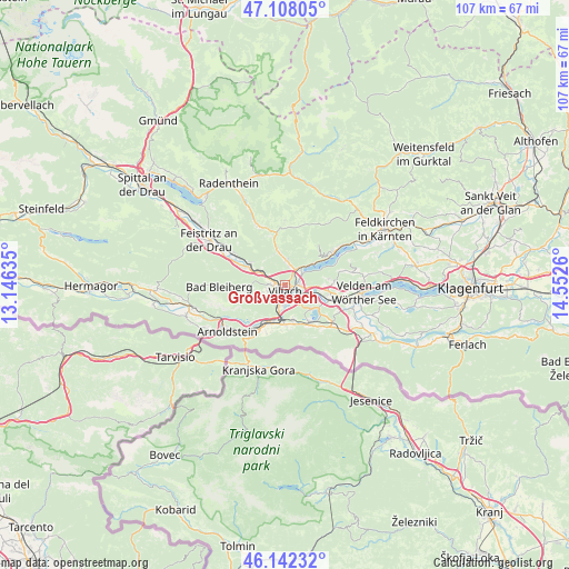
Großvassach GPS coordinates[2]
46° 37' 38.424" North, 13° 50' 58.092" East
| Map corner | latitude | longitude |
|---|---|---|
| Upper-left | 47.10805°, | 13.14635° |
| Center: | 46.62734°, | 13.84947° |
| Lower-right: | 46.14232°, | 14.5526° |
| Map W x H: | 107.4×107.4 km | = 66.7×66.7mi |
| max Lat: | 48.98333° ⇑97.2% North |
| Großvassach: | 46.62734° |
| min Lat: | ⇓2.8% South 46.48841° |
| min Long | Großvassach | max Long |
| 9.57802° | 13.84947° | 17.1° |
| W 32%⇐ | ⇒68% E |
Elevation
Elevation of Großvassach is 530 m = 1739 ft, and this is 24.5 m = 80 ft above average elevation for this country.
| Max E: |
2140 m = 7021 ft | 38.1% |
| Großvassach | 530 m 1739 ft | |
| Avg. | 505.5 m = 1658 ft | |
Min E: |
118 m = 387 ft | 61.9% |
See also: Austria elevation on elevation.city.
Geographical zone
Großvassach is located in North temperate zone (between Tropic of Cancer and the Arctic Circle). Distance of this North polar circle is 2216.7 km =1377.4 mi to North.| Distance of | km | miles | from Großvassach |
|---|---|---|---|
| North Pole | 4822.6 | 2996.6 | to North |
| Arctic Circle | 2216.7 | 1377.4 | to North |
| Tropic Cancer | 2578.6 | 1602.3 | to South |
| Equator | 5184.5 | 3221.5 | to South |


Nearby cities:
15 places around Großvassach: (largest is in red/bold)
• Auen
3.1 km =1.9 mi,  187°
187°
• Kleinvassach
0.5 km =0.3 mi,  33°
33°
• Landskron
2.8 km =1.7 mi,  114°
114°
• Lind
0.6 km =0.4 mi,  198°
198°
• Neufellach
2.7 km =1.7 mi,  257°
257°
• Obere Fellach
3.1 km =1.9 mi,  273°
273°
• Sankt Leonhard
0.7 km =0.4 mi, 108°
• Sankt Magdalen
2.8 km =1.7 mi, 114°
• Sankt Martin
1.9 km =1.2 mi,  234°
234°
• Seebach
1.8 km =1.1 mi,  132°
132°
• St. Agathen und Perau
2.4 km =1.5 mi,  167°
167°
• Untere Fellach
1.7 km =1.1 mi, 261°
• Villach
2 km =1.2 mi, 165°
• Villach-Innere Stadt
1.6 km =1 mi, 188°
• Völkendorf
2.5 km =1.6 mi,  212°
212°
Sources, notices
• [Note1] Compared only with cities in Austria existing in our database
• [Src1] Map data: © OpenStreetMap contributors (CC-BY-SA)
• [Src2] Other city data from geonames.org with taken over terms of usage.
• [Src3] Geographical zone / Annual Mean Temperature by Robert A. Rohde @ Wikipedia
