Lind geodata
Lind (Carinthia) is a section of populated place; located in Austria in Europe/Vienna (GMT+2) time zone. With population of 5,252 people, there are 182 cities with bigger population in this country. Compared to other cities in Austria, 97.6% of cities are located further ↑North; 68.1% of cities are located further →East and 59.3% of cities have lower elevation than Lind. Note1


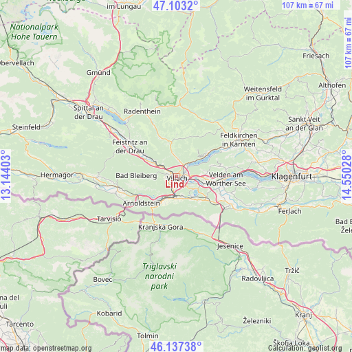
Lind GPS coordinates[2]
46° 37' 20.784" North, 13° 50' 49.74" East
| Map corner | latitude | longitude |
|---|---|---|
| Upper-left | 47.1032°, | 13.14403° |
| Center: | 46.62244°, | 13.84715° |
| Lower-right: | 46.13738°, | 14.55028° |
| Map W x H: | 107.4×107.4 km | = 66.7×66.7mi |
| max Lat: | 48.98333° ⇑97.6% North |
| Lind: | 46.62244° |
| min Lat: | ⇓2.4% South 46.48841° |
| min Long | Lind | max Long |
| 9.57802° | 13.84715° | 17.1° |
| W 31.9%⇐ | ⇒68.1% E |
Elevation
Elevation of Lind is 513 m = 1683 ft, and this is 7.5 m = 25 ft above average elevation for this country.
| Max E: |
2140 m = 7021 ft | 40.7% |
| Lind | 513 m 1683 ft | |
| Avg. | 505.5 m = 1658 ft | |
Min E: |
118 m = 387 ft | 59.3% |
See also: Austria elevation on elevation.city.
Geographical zone
Lind is located in North temperate zone (between Tropic of Cancer and the Arctic Circle). Distance of this North polar circle is 2217.2 km =1377.7 mi to North.| Distance of | km | miles | from Lind |
|---|---|---|---|
| North Pole | 4823.1 | 2996.9 | to North |
| Arctic Circle | 2217.2 | 1377.7 | to North |
| Tropic Cancer | 2578 | 1601.9 | to South |
| Equator | 5183.9 | 3221.1 | to South |


Nearby cities:
15 places around Lind: (largest is in red/bold)
• Auen
2.5 km =1.6 mi,  185°
185°
• Großvassach
0.6 km =0.4 mi,  18°
18°
• Kleinvassach
1 km =0.6 mi, 24°
• Landskron
2.8 km =1.7 mi,  103°
103°
• Neufellach
2.5 km =1.6 mi,  268°
268°
• Sankt Leonhard
0.9 km =0.6 mi,  70°
70°
• Sankt Magdalen
2.8 km =1.7 mi, 103°
• Sankt Martin
1.5 km =0.9 mi,  247°
247°
• Seebach
1.6 km =1 mi,  113°
113°
• St. Agathen und Perau
1.9 km =1.2 mi,  159°
159°
• Untere Fellach
1.6 km =1 mi,  280°
280°
• Villach
1.5 km =0.9 mi,  153°
153°
• Villach-Innere Stadt
1.1 km =0.7 mi,  183°
183°
• Völkendorf
2 km =1.2 mi,  216°
216°
• Warmbad-Judendorf
3 km =1.9 mi, 218°
Sources, notices
• [Note1] Compared only with cities in Austria existing in our database
• [Src1] Map data: © OpenStreetMap contributors (CC-BY-SA)
• [Src2] Other city data from geonames.org with taken over terms of usage.
• [Src3] Geographical zone / Annual Mean Temperature by Robert A. Rohde @ Wikipedia
