Völkendorf geodata
Völkendorf (Carinthia) is a section of populated place; located in Austria in Europe/Vienna (GMT+2) time zone. With population of 5,474 people, there are 174 cities with bigger population in this country. Compared to other cities in Austria, 98.3% of cities are located further ↑North; 68.4% of cities are located further →East and 60.4% of cities have lower elevation than Völkendorf. Note1


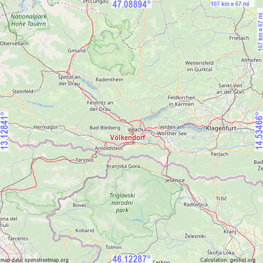
Völkendorf GPS coordinates[2]
46° 36' 29.016" North, 13° 49' 53.508" East
| Map corner | latitude | longitude |
|---|---|---|
| Upper-left | 47.08894°, | 13.12841° |
| Center: | 46.60806°, | 13.83153° |
| Lower-right: | 46.12287°, | 14.53466° |
| Map W x H: | 107.4×107.4 km | = 66.7×66.7mi |
| max Lat: | 48.98333° ⇑98.3% North |
| Völkendorf: | 46.60806° |
| min Lat: | ⇓1.7% South 46.48841° |
| min Long | Völkendorf | max Long |
| 9.57802° | 13.83153° | 17.1° |
| W 31.6%⇐ | ⇒68.4% E |
Elevation
Elevation of Völkendorf is 520 m = 1706 ft, and this is 14.5 m = 48 ft above average elevation for this country.
| Max E: |
2140 m = 7021 ft | 39.6% |
| Völkendorf | 520 m 1706 ft | |
| Avg. | 505.5 m = 1658 ft | |
Min E: |
118 m = 387 ft | 60.4% |
See also: Austria elevation on elevation.city.
Geographical zone
Völkendorf is located in North temperate zone (between Tropic of Cancer and the Arctic Circle). Distance of this North polar circle is 2218.8 km =1378.7 mi to North.| Distance of | km | miles | from Völkendorf |
|---|---|---|---|
| North Pole | 4824.7 | 2997.9 | to North |
| Arctic Circle | 2218.8 | 1378.7 | to North |
| Tropic Cancer | 2576.4 | 1600.9 | to South |
| Equator | 5182.3 | 3220.1 | to South |


Nearby cities:
15 places around Völkendorf: (largest is in red/bold)
• Auen
1.3 km =0.8 mi,  134°
134°
• Goritschach
1.8 km =1.1 mi,  284°
284°
• Großvassach
2.5 km =1.6 mi,  32°
32°
• Kleinvassach
3 km =1.9 mi, 32°
• Lind
2 km =1.2 mi,  36°
36°
• Neufellach
2 km =1.2 mi,  320°
320°
• Obere Fellach
2.9 km =1.8 mi, 323°
• Sankt Leonhard
2.8 km =1.7 mi,  47°
47°
• Sankt Martin
1 km =0.6 mi,  348°
348°
• Seebach
2.8 km =1.7 mi,  70°
70°
• St. Agathen und Perau
1.9 km =1.2 mi,  96°
96°
• Untere Fellach
1.9 km =1.2 mi, 349°
• Villach
1.9 km =1.2 mi,  82°
82°
• Villach-Innere Stadt
1.2 km =0.7 mi, 65°
• Warmbad-Judendorf
1 km =0.6 mi,  222°
222°
Sources, notices
• [Note1] Compared only with cities in Austria existing in our database
• [Src1] Map data: © OpenStreetMap contributors (CC-BY-SA)
• [Src2] Other city data from geonames.org with taken over terms of usage.
• [Src3] Geographical zone / Annual Mean Temperature by Robert A. Rohde @ Wikipedia
