Münchendorf geodata
Münchendorf (Lower Austria) is a seat of a third-order administrative division; located in Austria in Europe/Vienna (GMT+2) time zone. With population of 2,992 people, there are 380 cities with bigger population in this country. Compared to other cities in Austria, 68.5% of cities are located further ↓South; 90.8% of cities are located further ←West and 94.4% of cities have higher elevation than Münchendorf. Note1
Administrative division(s):
- Level 1: Lower Austria
- Level 2: Politischer Bezirk Mödling
- Level 3: Münchendorf


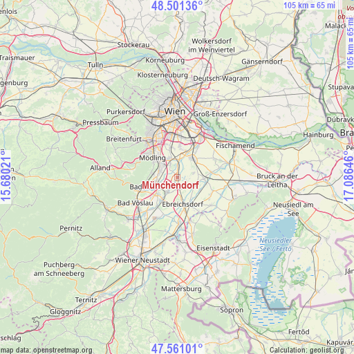
Münchendorf GPS coordinates[2]
48° 1' 59.988" North, 16° 22' 59.988" East
| Map corner | latitude | longitude |
|---|---|---|
| Upper-left | 48.50136°, | 15.68021° |
| Center: | 48.03333°, | 16.38333° |
| Lower-right: | 47.56101°, | 17.08646° |
| Map W x H: | 104.6×104.6 km | = 65×65mi |
| max Lat: | 48.98333° ⇑31.5% North |
| Münchendorf: | 48.03333° |
| min Lat: | ⇓68.5% South 46.48841° |
| min Long | Münchendorf | max Long |
| 9.57802° | 16.38333° | 17.1° |
| W 90.8%⇐ | ⇒9.2% E |
Elevation
Elevation of Münchendorf is 183 m = 600 ft, and this is 322.5 m = 1058 ft below average elevation for this country.
| Max E: |
2140 m = 7021 ft | 94.4% |
| Avg. | 505.5 m = 1658 ft | |
| Münchendorf | 183 m = 600 ft | |
Min E: |
118 m = 387 ft | 5.6% |
See also: Austria elevation on elevation.city.
Geographical zone
Münchendorf is located in North temperate zone (between Tropic of Cancer and the Arctic Circle). Distance of this North polar circle is 2060.4 km =1280.3 mi to North.| Distance of | km | miles | from Münchendorf |
|---|---|---|---|
| North Pole | 4666.3 | 2899.5 | to North |
| Arctic Circle | 2060.4 | 1280.3 | to North |
| Tropic Cancer | 2734.9 | 1699.4 | to South |
| Equator | 5340.8 | 3318.6 | to South |


Nearby cities:
15 places around Münchendorf: (largest is in red/bold)
• Achau
5.2 km =3.2 mi,  2°
2°
• Biedermannsdorf
6.3 km =3.9 mi,  333°
333°
• Guntramsdorf
5.4 km =3.4 mi,  286°
286°
• Himberg
6.7 km =4.2 mi,  33°
33°
• Laxenburg
4.4 km =2.7 mi, 332°
• Maria Lanzendorf
7.8 km =4.8 mi,  20°
20°
• Mitterndorf an der Fischa
7.8 km =4.8 mi,  120°
120°
• Moosbrunn
5.3 km =3.3 mi,  110°
110°
• Möllersdorf
5.9 km =3.7 mi,  261°
261°
• Neu-Guntramsdorf
6.1 km =3.8 mi,  304°
304°
• Traiskirchen
7 km =4.3 mi,  252°
252°
• Trumau
5.4 km =3.4 mi,  214°
214°
• Velm
3.7 km =2.3 mi,  90°
90°
• Wiener Neudorf
7.5 km =4.7 mi,  316°
316°
• Wienersdorf
7.4 km =4.6 mi, 247°
Sources, notices
• [Note1] Compared only with cities in Austria existing in our database
• [Src1] Map data: © OpenStreetMap contributors (CC-BY-SA)
• [Src2] Other city data from geonames.org with taken over terms of usage.
• [Src3] Geographical zone / Annual Mean Temperature by Robert A. Rohde @ Wikipedia
