Gossendorf geodata
Gossendorf (Styria) is a seat of a third-order administrative division; located in Austria in Europe/Vienna (GMT+2) time zone. With population of 630 people, there are 2033 cities with bigger population in this country. Compared to other cities in Austria, 87.7% of cities are located further ↑North; 78.2% of cities are located further ←West and 72.4% of cities have higher elevation than Gossendorf. Note1
Administrative division(s):
- Level 1: Styria
- Level 2: Politischer Bezirk Südoststeiermark
- Level 3: Feldbach


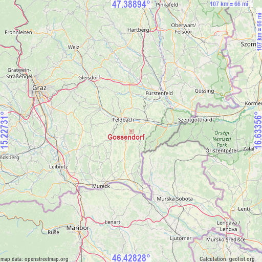
Gossendorf GPS coordinates[2]
46° 54' 38.736" North, 15° 55' 49.548" East
| Map corner | latitude | longitude |
|---|---|---|
| Upper-left | 47.38894°, | 15.22731° |
| Center: | 46.91076°, | 15.93043° |
| Lower-right: | 46.42828°, | 16.63356° |
| Map W x H: | 106.8×106.8 km | = 66.4×66.4mi |
| max Lat: | 48.98333° ⇑87.7% North |
| Gossendorf: | 46.91076° |
| min Lat: | ⇓12.3% South 46.48841° |
| min Long | Gossendorf | max Long |
| 9.57802° | 15.93043° | 17.1° |
| W 78.2%⇐ | ⇒21.8% E |
Elevation
Elevation of Gossendorf is 317 m = 1040 ft, and this is 188.5 m = 618 ft below average elevation for this country.
| Max E: |
2140 m = 7021 ft | 72.4% |
| Avg. | 505.5 m = 1658 ft | |
| Gossendorf | 317 m = 1040 ft | |
Min E: |
118 m = 387 ft | 27.6% |
See also: Austria elevation on elevation.city.
Geographical zone
Gossendorf is located in North temperate zone (between Tropic of Cancer and the Arctic Circle). Distance of this North polar circle is 2185.2 km =1357.8 mi to North.| Distance of | km | miles | from Gossendorf |
|---|---|---|---|
| North Pole | 4791.1 | 2977.1 | to North |
| Arctic Circle | 2185.2 | 1357.8 | to North |
| Tropic Cancer | 2610.1 | 1621.8 | to South |
| Equator | 5216 | 3241.1 | to South |


Nearby cities:
15 places around Gossendorf: (largest is in red/bold)
• Bad Gleichenberg
4.3 km =2.7 mi,  202°
202°
• Bairisch Kölldorf
4.9 km =3 mi,  177°
177°
• Feldbach
5.7 km =3.5 mi,  325°
325°
• Gleichenberg Dorf
3.8 km =2.4 mi,  217°
217°
• Kapfenstein
4.2 km =2.6 mi,  131°
131°
• Leitersdorf im Raabtal
3.5 km =2.2 mi,  4°
4°
• Lödersdorf
5.4 km =3.4 mi,  10°
10°
• Lödersdorf I
5.6 km =3.5 mi,  16°
16°
• Maierdorf
6.5 km =4 mi,  251°
251°
• Merkendorf
6.3 km =3.9 mi, 198°
• Mühldorf bei Feldbach
3.6 km =2.2 mi, 330°
• Oedt bei Feldbach
5.7 km =3.5 mi,  299°
299°
• Pertlstein
4.1 km =2.5 mi,  35°
35°
• Raabau
6 km =3.7 mi,  346°
346°
• Trautmannsdorf in Oststeiermark
5.3 km =3.3 mi, 221°
Sources, notices
• [Note1] Compared only with cities in Austria existing in our database
• [Src1] Map data: © OpenStreetMap contributors (CC-BY-SA)
• [Src2] Other city data from geonames.org with taken over terms of usage.
• [Src3] Geographical zone / Annual Mean Temperature by Robert A. Rohde @ Wikipedia
