Lödersdorf I geodata
Lödersdorf I (Styria) is a populated place; located in Austria in Europe/Vienna (GMT+2) time zone. With population of 577 people, there are 2221 cities with bigger population in this country. Compared to other cities in Austria, 85.9% of cities are located further ↑North; 78.9% of cities are located further ←West and 78.7% of cities have higher elevation than Lödersdorf I. Note1
Administrative division(s):
- Level 1: Styria
- Level 2: Politischer Bezirk Südoststeiermark
- Level 3: Riegersburg


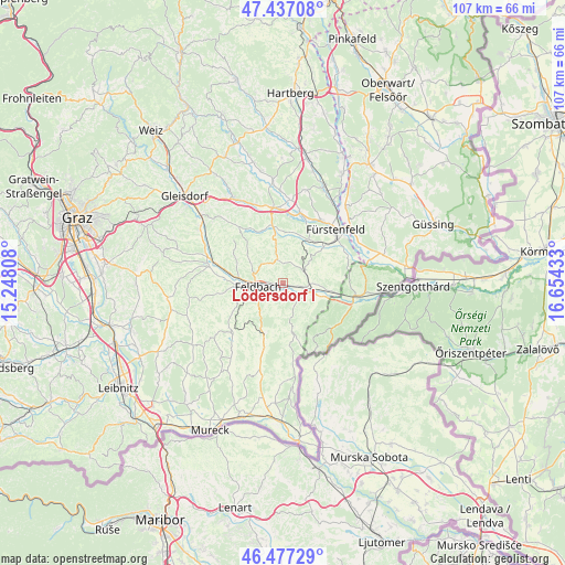
Lödersdorf I GPS coordinates[2]
46° 57' 33.624" North, 15° 57' 4.32" East
| Map corner | latitude | longitude |
|---|---|---|
| Upper-left | 47.43708°, | 15.24808° |
| Center: | 46.95934°, | 15.9512° |
| Lower-right: | 46.47729°, | 16.65433° |
| Map W x H: | 106.7×106.7 km | = 66.3×66.3mi |
| max Lat: | 48.98333° ⇑85.9% North |
| Lödersdorf I: | 46.95934° |
| min Lat: | ⇓14.1% South 46.48841° |
| min Long | Lödersdorf I | max Long |
| 9.57802° | 15.9512° | 17.1° |
| W 78.9%⇐ | ⇒21.1% E |
Elevation
Elevation of Lödersdorf I is 280 m = 919 ft, and this is 225.5 m = 740 ft below average elevation for this country.
| Max E: |
2140 m = 7021 ft | 78.7% |
| Avg. | 505.5 m = 1658 ft | |
| Lödersdorf I | 280 m = 919 ft | |
Min E: |
118 m = 387 ft | 21.3% |
See also: Austria elevation on elevation.city.
Geographical zone
Lödersdorf I is located in North temperate zone (between Tropic of Cancer and the Arctic Circle). Distance of this North polar circle is 2179.8 km =1354.5 mi to North.| Distance of | km | miles | from Lödersdorf I |
|---|---|---|---|
| North Pole | 4785.7 | 2973.7 | to North |
| Arctic Circle | 2179.8 | 1354.5 | to North |
| Tropic Cancer | 2615.5 | 1625.2 | to South |
| Equator | 5221.4 | 3244.4 | to South |


Nearby cities:
15 places around Lödersdorf I: (largest is in red/bold)
• Breitenfeld an der Rittschein
8.2 km =5.1 mi,  359°
359°
• Brunn
5.1 km =3.2 mi,  101°
101°
• Fehring
4.8 km =3 mi,  116°
116°
• Feldbach
4.8 km =3 mi,  261°
261°
• Gniebing
7.2 km =4.5 mi,  272°
272°
• Gossendorf
5.6 km =3.5 mi,  196°
196°
• Hatzendorf
4.3 km =2.7 mi,  62°
62°
• Leitersdorf im Raabtal
2.4 km =1.5 mi,  214°
214°
• Lödersdorf
0.6 km =0.4 mi, 262°
• Mühldorf bei Feldbach
4 km =2.5 mi,  235°
235°
• Oedt bei Feldbach
7 km =4.3 mi,  248°
248°
• Pertlstein
2.2 km =1.4 mi,  159°
159°
• Raabau
3 km =1.9 mi,  277°
277°
• Riegersburg
4.8 km =3 mi,  340°
340°
• Unterweissenbach
7.8 km =4.8 mi, 262°
Sources, notices
• [Note1] Compared only with cities in Austria existing in our database
• [Src1] Map data: © OpenStreetMap contributors (CC-BY-SA)
• [Src2] Other city data from geonames.org with taken over terms of usage.
• [Src3] Geographical zone / Annual Mean Temperature by Robert A. Rohde @ Wikipedia
