Maierdorf geodata
Maierdorf (Styria) is a seat of a third-order administrative division; located in Austria in Europe/Vienna (GMT+2) time zone. With population of 139 people, there are 2905 cities with bigger population in this country. Compared to other cities in Austria, 88% of cities are located further ↑North; 75.9% of cities are located further ←West and 72.6% of cities have higher elevation than Maierdorf. Note1
Administrative division(s):
- Level 1: Styria
- Level 2: Politischer Bezirk Südoststeiermark
- Level 3: Gnas


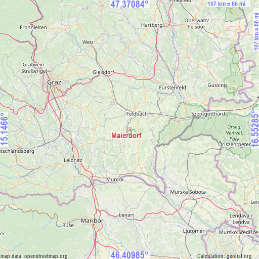
Maierdorf GPS coordinates[2]
46° 53' 33" North, 15° 50' 58.992" East
| Map corner | latitude | longitude |
|---|---|---|
| Upper-left | 47.37084°, | 15.1466° |
| Center: | 46.8925°, | 15.84972° |
| Lower-right: | 46.40985°, | 16.55285° |
| Map W x H: | 106.9×106.9 km | = 66.4×66.4mi |
| max Lat: | 48.98333° ⇑88% North |
| Maierdorf: | 46.8925° |
| min Lat: | ⇓12% South 46.48841° |
| min Long | Maierdorf | max Long |
| 9.57802° | 15.84972° | 17.1° |
| W 75.9%⇐ | ⇒24.1% E |
Elevation
Elevation of Maierdorf is 316 m = 1037 ft, and this is 189.5 m = 622 ft below average elevation for this country.
| Max E: |
2140 m = 7021 ft | 72.6% |
| Avg. | 505.5 m = 1658 ft | |
| Maierdorf | 316 m = 1037 ft | |
Min E: |
118 m = 387 ft | 27.4% |
See also: Austria elevation on elevation.city.
Geographical zone
Maierdorf is located in North temperate zone (between Tropic of Cancer and the Arctic Circle). Distance of this North polar circle is 2187.2 km =1359.1 mi to North.| Distance of | km | miles | from Maierdorf |
|---|---|---|---|
| North Pole | 4793.1 | 2978.3 | to North |
| Arctic Circle | 2187.2 | 1359.1 | to North |
| Tropic Cancer | 2608 | 1620.5 | to South |
| Equator | 5214 | 3239.8 | to South |


Nearby cities:
15 places around Maierdorf: (largest is in red/bold)
• Bad Gleichenberg
4.9 km =3 mi,  112°
112°
• Burgfried
1.9 km =1.2 mi,  219°
219°
• Gleichenberg Dorf
4 km =2.5 mi,  104°
104°
• Gnas
2.8 km =1.7 mi, 220°
• Gossendorf
6.5 km =4 mi,  71°
71°
• Grabersdorf
5.8 km =3.6 mi,  199°
199°
• Kohlberg
5.1 km =3.2 mi,  279°
279°
• Krusdorf
6 km =3.7 mi,  171°
171°
• Merkendorf
5.7 km =3.5 mi,  133°
133°
• Oedt bei Feldbach
5 km =3.1 mi,  13°
13°
• Perlsdorf
3.6 km =2.2 mi,  310°
310°
• Poppendorf
4.1 km =2.5 mi, 172°
• Raning
5.4 km =3.4 mi,  207°
207°
• Trautmannsdorf in Oststeiermark
3.3 km =2.1 mi, 125°
• Unterweissenbach
6.4 km =4 mi,  0°
0°
Sources, notices
• [Note1] Compared only with cities in Austria existing in our database
• [Src1] Map data: © OpenStreetMap contributors (CC-BY-SA)
• [Src2] Other city data from geonames.org with taken over terms of usage.
• [Src3] Geographical zone / Annual Mean Temperature by Robert A. Rohde @ Wikipedia
