Freistadt geodata
Freistadt (Upper Austria) is a populated place; located in Austria in Europe/Vienna (GMT+2) time zone. With population of 7,397 people, there are 125 cities with bigger population in this country. Compared to other cities in Austria, 94.6% of cities are located further ↓South; 53.1% of cities are located further →East and 66.9% of cities have lower elevation than Freistadt. Note1
Administrative division(s):
- Level 1: Upper Austria
- Level 2: Politischer Bezirk Freistadt
- Level 3: Freistadt


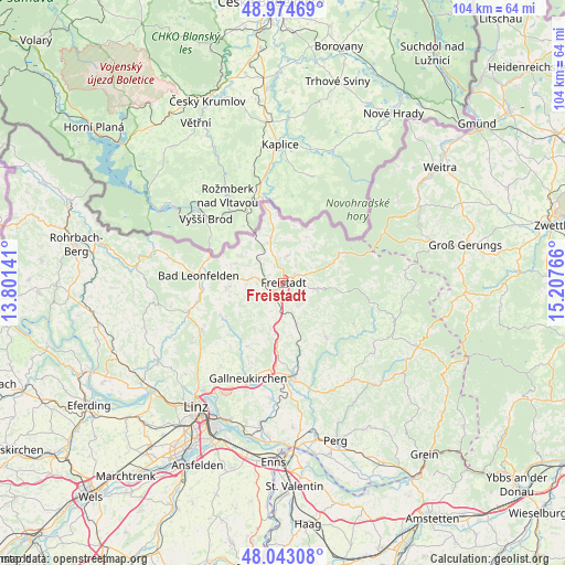
Freistadt GPS coordinates[2]
48° 30' 39.708" North, 14° 30' 16.308" East
| Map corner | latitude | longitude |
|---|---|---|
| Upper-left | 48.97469°, | 13.80141° |
| Center: | 48.51103°, | 14.50453° |
| Lower-right: | 48.04308°, | 15.20766° |
| Map W x H: | 103.6×103.6 km | = 64.4×64.4mi |
| max Lat: | 48.98333° ⇑5.4% North |
| Freistadt: | 48.51103° |
| min Lat: | ⇓94.6% South 46.48841° |
| min Long | Freistadt | max Long |
| 9.57802° | 14.50453° | 17.1° |
| W 46.9%⇐ | ⇒53.1% E |
Elevation
Elevation of Freistadt is 565 m = 1854 ft, and this is 59.5 m = 195 ft above average elevation for this country.
| Max E: |
2140 m = 7021 ft | 33.1% |
| Freistadt | 565 m 1854 ft | |
| Avg. | 505.5 m = 1658 ft | |
Min E: |
118 m = 387 ft | 66.9% |
See also: Austria elevation on elevation.city.
Geographical zone
Freistadt is located in North temperate zone (between Tropic of Cancer and the Arctic Circle). Distance of this North polar circle is 2007.3 km =1247.3 mi to North.| Distance of | km | miles | from Freistadt |
|---|---|---|---|
| North Pole | 4613.1 | 2866.4 | to North |
| Arctic Circle | 2007.3 | 1247.3 | to North |
| Tropic Cancer | 2788 | 1732.4 | to South |
| Equator | 5393.9 | 3351.6 | to South |


Nearby cities:
15 places around Freistadt: (largest is in red/bold)
• Alberndorf in der Riedmark
13.4 km =8.3 mi,  209°
209°
• Grünbach
3.8 km =2.4 mi,  37°
37°
• Gutau
13.1 km =8.1 mi,  142°
142°
• Kefermarkt
8 km =5 mi,  161°
161°
• Lasberg
5.2 km =3.2 mi,  149°
149°
• Neumarkt im Mühlkreis
9.3 km =5.8 mi,  189°
189°
• Ottenschlag im Mühlkreis
10.1 km =6.3 mi,  240°
240°
• Rainbach im Mühlkreis
5.6 km =3.5 mi,  336°
336°
• Reichenau im Mühlkreis
13 km =8.1 mi, 242°
• Reichenthal
9.5 km =5.9 mi,  291°
291°
• Sandl
11.6 km =7.2 mi,  61°
61°
• Sankt Oswald bei Freistadt
5.9 km =3.7 mi,  101°
101°
• Schenkenfelden
10.5 km =6.5 mi,  264°
264°
• Summerau
6.5 km =4 mi,  314°
314°
• Windhaag bei Freistadt
9.5 km =5.9 mi,  26°
26°
Sources, notices
• [Note1] Compared only with cities in Austria existing in our database
• [Src1] Map data: © OpenStreetMap contributors (CC-BY-SA)
• [Src2] Other city data from geonames.org with taken over terms of usage.
• [Src3] Geographical zone / Annual Mean Temperature by Robert A. Rohde @ Wikipedia
