Schenkenfelden geodata
Schenkenfelden (Upper Austria) is a seat of a third-order administrative division; located in Austria in Europe/Vienna (GMT+2) time zone. With population of 1,129 people, there are 1127 cities with bigger population in this country. Compared to other cities in Austria, 94.5% of cities are located further ↓South; 56.5% of cities are located further →East and 81% of cities have lower elevation than Schenkenfelden. Note1
Administrative division(s):
- Level 1: Upper Austria
- Level 2: Politischer Bezirk Urfahr-Umgebung
- Level 3: Schenkenfelden


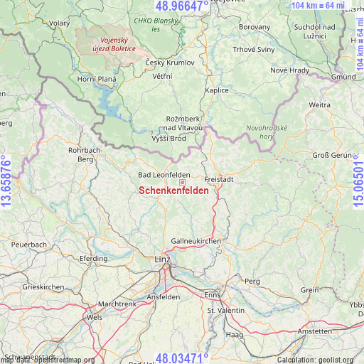
Schenkenfelden GPS coordinates[2]
48° 30' 9.828" North, 14° 21' 42.768" East
| Map corner | latitude | longitude |
|---|---|---|
| Upper-left | 48.96647°, | 13.65876° |
| Center: | 48.50273°, | 14.36188° |
| Lower-right: | 48.03471°, | 15.06501° |
| Map W x H: | 103.6×103.6 km | = 64.4×64.4mi |
| max Lat: | 48.98333° ⇑5.5% North |
| Schenkenfelden: | 48.50273° |
| min Lat: | ⇓94.5% South 46.48841° |
| min Long | Schenkenfelden | max Long |
| 9.57802° | 14.36188° | 17.1° |
| W 43.5%⇐ | ⇒56.5% E |
Elevation
Elevation of Schenkenfelden is 737 m = 2418 ft, and this is 231.5 m = 760 ft above average elevation for this country.
| Max E: |
2140 m = 7021 ft | 19% |
| Schenkenfelden | 737 m 2418 ft | |
| Avg. | 505.5 m = 1658 ft | |
Min E: |
118 m = 387 ft | 81% |
See also: Austria elevation on elevation.city.
Geographical zone
Schenkenfelden is located in North temperate zone (between Tropic of Cancer and the Arctic Circle). Distance of this North polar circle is 2008.2 km =1247.8 mi to North.| Distance of | km | miles | from Schenkenfelden |
|---|---|---|---|
| North Pole | 4614.1 | 2867.1 | to North |
| Arctic Circle | 2008.2 | 1247.8 | to North |
| Tropic Cancer | 2787.1 | 1731.8 | to South |
| Equator | 5393 | 3351.1 | to South |


Nearby cities:
15 places around Schenkenfelden: (largest is in red/bold)
• Alberndorf in der Riedmark
11.4 km =7.1 mi,  160°
160°
• Bad Leonfelden
5.3 km =3.3 mi,  291°
291°
• Burgfried
5.2 km =3.2 mi, 291°
• Freistadt
10.5 km =6.5 mi,  84°
84°
• Haibach im Mühlkreis
6.6 km =4.1 mi,  191°
191°
• Hellmonsödt
9 km =5.6 mi,  210°
210°
• Kirchschlag bei Linz
11.9 km =7.4 mi, 211°
• Oberneukirchen
11.1 km =6.9 mi,  247°
247°
• Ottenschlag im Mühlkreis
4.4 km =2.7 mi, 157°
• Rainbach im Mühlkreis
10.3 km =6.4 mi,  53°
53°
• Reichenau im Mühlkreis
5.2 km =3.2 mi, 190°
• Reichenthal
4.8 km =3 mi,  20°
20°
• Sonnberg im Mühlkreis
6 km =3.7 mi,  218°
218°
• Summerau
8 km =5 mi, 46°
• Zwettl an der Rodl
7.9 km =4.9 mi,  238°
238°
Sources, notices
• [Note1] Compared only with cities in Austria existing in our database
• [Src1] Map data: © OpenStreetMap contributors (CC-BY-SA)
• [Src2] Other city data from geonames.org with taken over terms of usage.
• [Src3] Geographical zone / Annual Mean Temperature by Robert A. Rohde @ Wikipedia
