Reichenthal geodata
Reichenthal (Upper Austria) is a seat of a third-order administrative division; located in Austria in Europe/Vienna (GMT+2) time zone. With population of 915 people, there are 1404 cities with bigger population in this country. Compared to other cities in Austria, 95.4% of cities are located further ↓South; 55.9% of cities are located further →East and 77.8% of cities have lower elevation than Reichenthal. Note1
Administrative division(s):
- Level 1: Upper Austria
- Level 2: Politischer Bezirk Urfahr-Umgebung
- Level 3: Reichenthal


Reichenthal GPS coordinates[2]
48° 32' 34.296" North, 14° 23' 4.956" East
| Map corner | latitude | longitude |
|---|---|---|
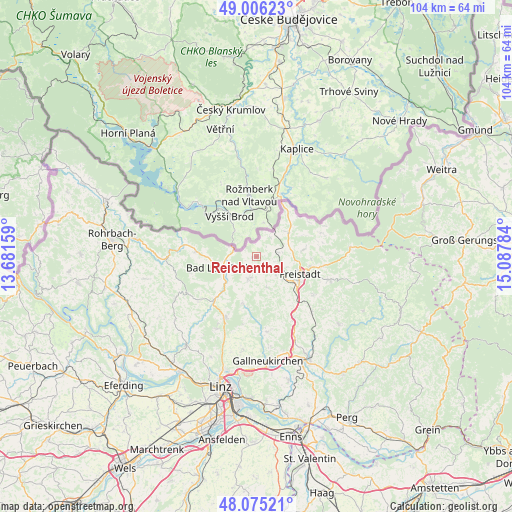
| Upper-left | 49.00623°, | 13.68159° |
| Center: | 48.54286°, | 14.38471° |
| Lower-right: | 48.07521°, | 15.08784° |
| Map W x H: | 103.5×103.5 km | = 64.3×64.3mi |
| max Lat: | 48.98333° ⇑4.6% North |
| Reichenthal: | 48.54286° |
| min Lat: | ⇓95.4% South 46.48841° |
| min Long | Reichenthal | max Long |
| 9.57802° | 14.38471° | 17.1° |
| W 44.1%⇐ | ⇒55.9% E |
Elevation
Elevation of Reichenthal is 685 m = 2247 ft, and this is 179.5 m = 589 ft above average elevation for this country.
| Max E: |
2140 m = 7021 ft | 22.2% |
| Reichenthal | 685 m 2247 ft | |
| Avg. | 505.5 m = 1658 ft | |
Min E: |
118 m = 387 ft | 77.8% |
See also: Austria elevation on elevation.city.
Geographical zone
Reichenthal is located in North temperate zone (between Tropic of Cancer and the Arctic Circle). Distance of this North polar circle is 2003.7 km =1245 mi to North.| Distance of | km | miles | from Reichenthal |
|---|---|---|---|
| North Pole | 4609.6 | 2864.3 | to North |
| Arctic Circle | 2003.7 | 1245 | to North |
| Tropic Cancer | 2791.5 | 1734.6 | to South |
| Equator | 5397.5 | 3353.8 | to South |


Nearby cities:
15 places around Reichenthal: (largest is in red/bold)
• Bad Leonfelden
7.1 km =4.4 mi,  249°
249°
• Burgfried
7 km =4.3 mi, 248°
• Freistadt
9.5 km =5.9 mi,  111°
111°
• Grünbach
11.1 km =6.9 mi,  92°
92°
• Haibach im Mühlkreis
11.4 km =7.1 mi,  195°
195°
• Hellmonsödt
13.7 km =8.5 mi,  207°
207°
• Ottenschlag im Mühlkreis
8.5 km =5.3 mi,  180°
180°
• Rainbach im Mühlkreis
6.8 km =4.2 mi,  76°
76°
• Reichenau im Mühlkreis
9.9 km =6.2 mi, 195°
• Schenkenfelden
4.8 km =3 mi, 200°
• Sonnberg im Mühlkreis
10.6 km =6.6 mi, 210°
• Summerau
4.2 km =2.6 mi, 76°
• Vorderweissenbach
12.3 km =7.6 mi,  274°
274°
• Windhaag bei Freistadt
14 km =8.7 mi,  69°
69°
• Zwettl an der Rodl
12 km =7.5 mi,  224°
224°
Sources, notices
• [Note1] Compared only with cities in Austria existing in our database
• [Src1] Map data: © OpenStreetMap contributors (CC-BY-SA)
• [Src2] Other city data from geonames.org with taken over terms of usage.
• [Src3] Geographical zone / Annual Mean Temperature by Robert A. Rohde @ Wikipedia
