Gutau geodata
Gutau (Upper Austria) is a seat of a third-order administrative division; located in Austria in Europe/Vienna (GMT+1) time zone. With population of 1,097 people, there are 1163 cities with bigger population in this country. Compared to other cities in Austria, 91.5% of cities are located further ↓South; 51.5% of cities are located further →East and 70.5% of cities have lower elevation than Gutau. Note1
Administrative division(s):
- Level 1: Upper Austria
- Level 2: Politischer Bezirk Freistadt
- Level 3: Gutau


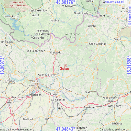
Gutau GPS coordinates[2]
48° 25' 2.064" North, 14° 36' 46.26" East
| Map corner | latitude | longitude |
|---|---|---|
| Upper-left | 48.88176°, | 13.90973° |
| Center: | 48.41724°, | 14.61285° |
| Lower-right: | 47.94843°, | 15.31598° |
| Map W x H: | 103.8×103.8 km | = 64.5×64.5mi |
| max Lat: | 48.98333° ⇑8.5% North |
| Gutau: | 48.41724° |
| min Lat: | ⇓91.5% South 46.48841° |
| min Long | Gutau | max Long |
| 9.57802° | 14.61285° | 17.1° |
| W 48.5%⇐ | ⇒51.5% E |
Elevation
Elevation of Gutau is 594 m = 1949 ft, and this is 88.5 m = 290 ft above average elevation for this country.
| Max E: |
2140 m = 7021 ft | 29.5% |
| Gutau | 594 m 1949 ft | |
| Avg. | 505.5 m = 1658 ft | |
Min E: |
118 m = 387 ft | 70.5% |
See also: Austria elevation on elevation.city.
Geographical zone
Gutau is located in North temperate zone (between Tropic of Cancer and the Arctic Circle). Distance of this North polar circle is 2017.7 km =1253.7 mi to North.| Distance of | km | miles | from Gutau |
|---|---|---|---|
| North Pole | 4623.6 | 2873 | to North |
| Arctic Circle | 2017.7 | 1253.7 | to North |
| Tropic Cancer | 2777.6 | 1725.9 | to South |
| Equator | 5383.5 | 3345.2 | to South |


Nearby cities:
15 places around Gutau: (largest is in red/bold)
• Bad Zell
8.7 km =5.4 mi,  151°
151°
• Grünbichl
10.1 km =6.3 mi,  221°
221°
• Hagenberg im Mühlkreis
9 km =5.6 mi,  232°
232°
• Kefermarkt
6.2 km =3.9 mi,  297°
297°
• Lasberg
8 km =5 mi,  318°
318°
• Neumarkt im Mühlkreis
9.6 km =6 mi,  277°
277°
• Pregarten
9.1 km =5.7 mi, 220°
• Sankt Leonhard bei Freistadt
5.7 km =3.5 mi,  58°
58°
• Sankt Oswald bei Freistadt
9.5 km =5.9 mi,  346°
346°
• Schönau im Mühlkreis
9 km =5.6 mi,  106°
106°
• Tragwein
9.4 km =5.8 mi,  175°
175°
• Unterweissenbach
12.7 km =7.9 mi,  80°
80°
• Unterweitersdorf
12.1 km =7.5 mi,  242°
242°
• Wartberg ob der Aist
10.9 km =6.8 mi, 225°
• Weitersfelden
10.7 km =6.6 mi,  51°
51°
Sources, notices
• [Note1] Compared only with cities in Austria existing in our database
• [Src1] Map data: © OpenStreetMap contributors (CC-BY-SA)
• [Src2] Other city data from geonames.org with taken over terms of usage.
• [Src3] Geographical zone / Annual Mean Temperature by Robert A. Rohde @ Wikipedia
