Fölz geodata
Fölz (Styria) is a populated place; located in Austria in Europe/Vienna (GMT+2) time zone. With population of 652 people, there are 1978 cities with bigger population in this country. Compared to other cities in Austria, 52.3% of cities are located further ↑North; 58.4% of cities are located further ←West and 78.7% of cities have lower elevation than Fölz. Note1
Administrative division(s):
- Level 1: Styria
- Level 2: Politischer Bezirk Bruck-Mürzzuschlag
- Level 3: Thörl


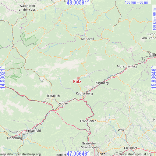
Fölz GPS coordinates[2]
47° 31' 59.988" North, 15° 13' 59.988" East
| Map corner | latitude | longitude |
|---|---|---|
| Upper-left | 48.00591°, | 14.53021° |
| Center: | 47.53333°, | 15.23333° |
| Lower-right: | 47.05646°, | 15.93646° |
| Map W x H: | 105.6×105.6 km | = 65.6×65.6mi |
| max Lat: | 48.98333° ⇑52.3% North |
| Fölz: | 47.53333° |
| min Lat: | ⇓47.7% South 46.48841° |
| min Long | Fölz | max Long |
| 9.57802° | 15.23333° | 17.1° |
| W 58.4%⇐ | ⇒41.6% E |
Elevation
Elevation of Fölz is 696 m = 2283 ft, and this is 190.5 m = 625 ft above average elevation for this country.
| Max E: |
2140 m = 7021 ft | 21.3% |
| Fölz | 696 m 2283 ft | |
| Avg. | 505.5 m = 1658 ft | |
Min E: |
118 m = 387 ft | 78.7% |
See also: Austria elevation on elevation.city.
Geographical zone
Fölz is located in North temperate zone (between Tropic of Cancer and the Arctic Circle). Distance of this North polar circle is 2116 km =1314.8 mi to North.| Distance of | km | miles | from Fölz |
|---|---|---|---|
| North Pole | 4721.9 | 2934.1 | to North |
| Arctic Circle | 2116 | 1314.8 | to North |
| Tropic Cancer | 2679.3 | 1664.8 | to South |
| Equator | 5285.2 | 3284.1 | to South |


Nearby cities:
15 places around Fölz: (largest is in red/bold)
• Aflenz Kurort
1.1 km =0.7 mi,  23°
23°
• Deuchendorf
10 km =6.2 mi,  138°
138°
• Diemlach
11.2 km =7 mi,  163°
163°
• Gassing
10.7 km =6.6 mi,  129°
129°
• Göritz
9.1 km =5.7 mi, 125°
• Hafendorf
10.7 km =6.6 mi, 143°
• Kapfenberg
10.8 km =6.7 mi, 155°
• Palbersdorf
0 km =0 mi,  0°
0°
• Parschlug
7.1 km =4.4 mi,  145°
145°
• Sankt Ilgen
5.3 km =3.3 mi,  290°
290°
• Sankt Katharein an der Laming
8.7 km =5.4 mi,  217°
217°
• Sankt Lorenzen im Mürztal
11.5 km =7.1 mi,  119°
119°
• Sankt Martin
10.4 km =6.5 mi, 158°
• Thörl
1.7 km =1.1 mi,  207°
207°
• Turnau
8.3 km =5.2 mi,  70°
70°
Sources, notices
• [Note1] Compared only with cities in Austria existing in our database
• [Src1] Map data: © OpenStreetMap contributors (CC-BY-SA)
• [Src2] Other city data from geonames.org with taken over terms of usage.
• [Src3] Geographical zone / Annual Mean Temperature by Robert A. Rohde @ Wikipedia
