Feldkirchen an der Donau geodata
Feldkirchen an der Donau (Upper Austria) is a seat of a third-order administrative division; located in Austria in Europe/Vienna (GMT+2) time zone. With population of 903 people, there are 1422 cities with bigger population in this country. Compared to other cities in Austria, 88.1% of cities are located further ↓South; 63.7% of cities are located further →East and 81.8% of cities have higher elevation than Feldkirchen an der Donau. Note1
Administrative division(s):
- Level 1: Upper Austria
- Level 2: Politischer Bezirk Urfahr-Umgebung
- Level 3: Feldkirchen an der Donau
Current local time in Feldkirchen an der Donau:
10:40 PM, FridayDifference from your time zone: hours


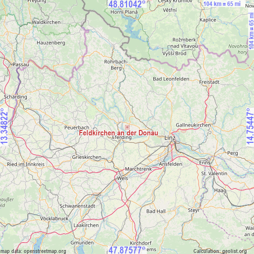
Feldkirchen an der Donau GPS coordinates[2]
48° 20' 42.864" North, 14° 3' 4.824" East
| Map corner | latitude | longitude |
|---|---|---|
| Upper-left | 48.81042°, | 13.34822° |
| Center: | 48.34524°, | 14.05134° |
| Lower-right: | 47.87577°, | 14.75447° |
| Map W x H: | 103.9×103.9 km | = 64.6×64.6mi |
| max Lat: | 48.98333° ⇑11.9% North |
| Feldkirchen an der Donau: | 48.34524° |
| min Lat: | ⇓88.1% South 46.48841° |
| min Long | Feldkirchen an | max Long |
| 9.57802° | 14.05134° | 17.1° |
| W 36.3%⇐ | ⇒63.7% E |
Elevation
Elevation of Feldkirchen an der Donau is 266 m = 873 ft, and this is 239.5 m = 786 ft below average elevation for this country.
| Max E: |
2140 m = 7021 ft | 81.8% |
| Avg. | 505.5 m = 1658 ft | |
| Feldkirchen an der Donau | 266 m = 873 ft | |
Min E: |
118 m = 387 ft | 18.2% |
See also: Austria elevation on elevation.city.
Geographical zone
Feldkirchen an der Donau is located in North temperate zone (between Tropic of Cancer and the Arctic Circle). Distance of this North polar circle is 2025.7 km =1258.7 mi to North.| Distance of | km | miles | from Feldkirchen an der Donau |
|---|---|---|---|
| North Pole | 4631.6 | 2877.9 | to North |
| Arctic Circle | 2025.7 | 1258.7 | to North |
| Tropic Cancer | 2769.6 | 1720.9 | to South |
| Equator | 5375.5 | 3340.2 | to South |


Nearby cities:
15 places around Feldkirchen an der Donau: (largest is in red/bold)
• Alkoven
7.6 km =4.7 mi,  147°
147°
• Aschach an der Donau
3.1 km =1.9 mi,  313°
313°
• Bergheim
1.6 km =1 mi,  357°
357°
• Eferding
4.6 km =2.9 mi,  207°
207°
• Fraham
7 km =4.3 mi,  192°
192°
• Freudenstein
3.3 km =2.1 mi,  77°
77°
• Goldwörth
4.2 km =2.6 mi,  119°
119°
• Hartheim
8.5 km =5.3 mi, 147°
• Hartkirchen
4 km =2.5 mi,  300°
300°
• Lacken
5 km =3.1 mi,  34°
34°
• Ottensheim
9.2 km =5.7 mi,  98°
98°
• Sankt Gotthard im Mühlkreis
7.1 km =4.4 mi,  56°
56°
• Sankt Martin im Mühlkreis
7.9 km =4.9 mi,  352°
352°
• Schönering
9.6 km =6 mi, 122°
• Walding
7.9 km =4.9 mi, 84°
In other languages:
- In German: Feldkirchen an der Donau, Feldkirchen a. d. Donau
- In Russian: Фельдкирхен-ан-дер-Донау
- In Chinese: 多瑙河畔费德基兴
Sources, notices
• [Note1] Compared only with cities in Austria existing in our database
• [Src1] Map data: © OpenStreetMap contributors (CC-BY-SA)
• [Src2] Other city data from geonames.org with taken over terms of usage.
• [Src3] Geographical zone / Annual Mean Temperature by Robert A. Rohde @ Wikipedia
