Eferding geodata
Eferding (Upper Austria) is a populated place; located in Austria in Europe/Vienna (GMT+2) time zone. With population of 4,100 people, there are 252 cities with bigger population in this country. Compared to other cities in Austria, 86.3% of cities are located further ↓South; 64.4% of cities are located further →East and 80.8% of cities have higher elevation than Eferding. Note1
Administrative division(s):
- Level 1: Upper Austria
- Level 2: Politischer Bezirk Eferding
- Level 3: Eferding


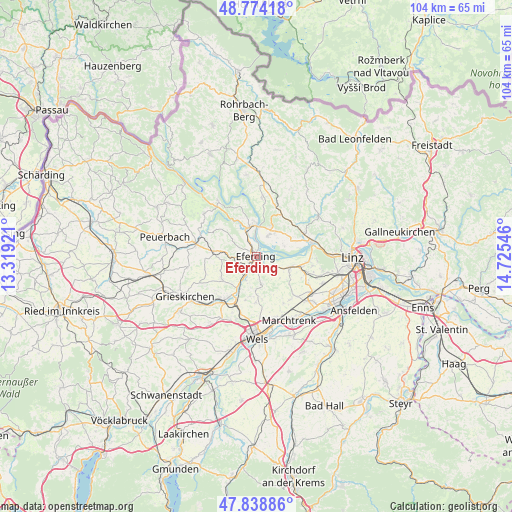
Eferding GPS coordinates[2]
48° 18' 31.176" North, 14° 1' 20.388" East
| Map corner | latitude | longitude |
|---|---|---|
| Upper-left | 48.77418°, | 13.31921° |
| Center: | 48.30866°, | 14.02233° |
| Lower-right: | 47.83886°, | 14.72546° |
| Map W x H: | 104×104 km | = 64.6×64.6mi |
| max Lat: | 48.98333° ⇑13.7% North |
| Eferding: | 48.30866° |
| min Lat: | ⇓86.3% South 46.48841° |
| min Long | Eferding | max Long |
| 9.57802° | 14.02233° | 17.1° |
| W 35.6%⇐ | ⇒64.4% E |
Elevation
Elevation of Eferding is 271 m = 889 ft, and this is 234.5 m = 769 ft below average elevation for this country.
| Max E: |
2140 m = 7021 ft | 80.8% |
| Avg. | 505.5 m = 1658 ft | |
| Eferding | 271 m = 889 ft | |
Min E: |
118 m = 387 ft | 19.2% |
See also: Austria elevation on elevation.city.
Geographical zone
Eferding is located in North temperate zone (between Tropic of Cancer and the Arctic Circle). Distance of this North polar circle is 2029.8 km =1261.3 mi to North.| Distance of | km | miles | from Eferding |
|---|---|---|---|
| North Pole | 4635.6 | 2880.4 | to North |
| Arctic Circle | 2029.8 | 1261.3 | to North |
| Tropic Cancer | 2765.5 | 1718.4 | to South |
| Equator | 5371.4 | 3337.6 | to South |


Nearby cities:
15 places around Eferding: (largest is in red/bold)
• Alkoven
6.7 km =4.2 mi,  110°
110°
• Aschach an der Donau
6.2 km =3.9 mi,  358°
358°
• Bergheim
6 km =3.7 mi,  20°
20°
• Buchkirchen
9.4 km =5.8 mi,  179°
179°
• Feldkirchen an der Donau
4.6 km =2.9 mi,  27°
27°
• Fraham
2.8 km =1.7 mi,  167°
167°
• Freudenstein
7.2 km =4.5 mi,  48°
48°
• Goldwörth
6.2 km =3.9 mi,  71°
71°
• Hartheim
7.5 km =4.7 mi, 114°
• Hartkirchen
6.2 km =3.9 mi,  347°
347°
• Lacken
9.6 km =6 mi, 31°
• Prambachkirchen
8.8 km =5.5 mi,  276°
276°
• Sankt Marienkirchen an der Polsenz
8.3 km =5.2 mi,  234°
234°
• Strassham
9.5 km =5.9 mi, 107°
• Unterfreundorf
8.1 km =5 mi, 228°
Sources, notices
• [Note1] Compared only with cities in Austria existing in our database
• [Src1] Map data: © OpenStreetMap contributors (CC-BY-SA)
• [Src2] Other city data from geonames.org with taken over terms of usage.
• [Src3] Geographical zone / Annual Mean Temperature by Robert A. Rohde @ Wikipedia
