Freudenstein geodata
Freudenstein (Upper Austria) is a populated place; located in Austria in Europe/Vienna (GMT+2) time zone. With population of 518 people, there are 2438 cities with bigger population in this country. Compared to other cities in Austria, 88.6% of cities are located further ↓South; 63% of cities are located further →East and 78.5% of cities have higher elevation than Freudenstein. Note1
Administrative division(s):
- Level 1: Upper Austria
- Level 2: Politischer Bezirk Urfahr-Umgebung
- Level 3: Feldkirchen an der Donau


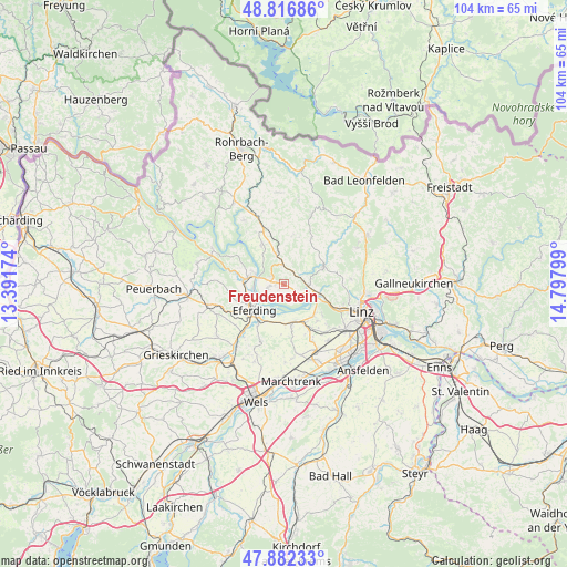
Freudenstein GPS coordinates[2]
48° 21' 6.264" North, 14° 5' 41.496" East
| Map corner | latitude | longitude |
|---|---|---|
| Upper-left | 48.81686°, | 13.39174° |
| Center: | 48.35174°, | 14.09486° |
| Lower-right: | 47.88233°, | 14.79799° |
| Map W x H: | 103.9×103.9 km | = 64.6×64.6mi |
| max Lat: | 48.98333° ⇑11.4% North |
| Freudenstein: | 48.35174° |
| min Lat: | ⇓88.6% South 46.48841° |
| min Long | Freudenstein | max Long |
| 9.57802° | 14.09486° | 17.1° |
| W 37%⇐ | ⇒63% E |
Elevation
Elevation of Freudenstein is 281 m = 922 ft, and this is 224.5 m = 737 ft below average elevation for this country.
| Max E: |
2140 m = 7021 ft | 78.5% |
| Avg. | 505.5 m = 1658 ft | |
| Freudenstein | 281 m = 922 ft | |
Min E: |
118 m = 387 ft | 21.5% |
See also: Austria elevation on elevation.city.
Geographical zone
Freudenstein is located in North temperate zone (between Tropic of Cancer and the Arctic Circle). Distance of this North polar circle is 2025 km =1258.3 mi to North.| Distance of | km | miles | from Freudenstein |
|---|---|---|---|
| North Pole | 4630.9 | 2877.5 | to North |
| Arctic Circle | 2025 | 1258.3 | to North |
| Tropic Cancer | 2770.3 | 1721.4 | to South |
| Equator | 5376.2 | 3340.6 | to South |


Nearby cities:
15 places around Freudenstein: (largest is in red/bold)
• Alkoven
7.2 km =4.5 mi,  172°
172°
• Aschach an der Donau
5.7 km =3.5 mi,  284°
284°
• Bergheim
3.4 km =2.1 mi, 284°
• Edramsberg
7.3 km =4.5 mi,  126°
126°
• Eferding
7.2 km =4.5 mi,  228°
228°
• Feldkirchen an der Donau
3.3 km =2.1 mi,  257°
257°
• Goldwörth
2.8 km =1.7 mi, 170°
• Gramastetten
7.8 km =4.8 mi,  66°
66°
• Hartkirchen
6.8 km =4.2 mi, 281°
• Lacken
3.4 km =2.1 mi,  353°
353°
• Niederottensheim
6.8 km =4.2 mi,  101°
101°
• Ottensheim
6.2 km =3.9 mi,  110°
110°
• Sankt Gotthard im Mühlkreis
4.2 km =2.6 mi,  40°
40°
• Schönering
7.7 km =4.8 mi,  140°
140°
• Walding
4.6 km =2.9 mi,  89°
89°
Sources, notices
• [Note1] Compared only with cities in Austria existing in our database
• [Src1] Map data: © OpenStreetMap contributors (CC-BY-SA)
• [Src2] Other city data from geonames.org with taken over terms of usage.
• [Src3] Geographical zone / Annual Mean Temperature by Robert A. Rohde @ Wikipedia
