Eschenau geodata
Eschenau (Lower Austria) is a seat of a third-order administrative division; located in Austria in Europe/Vienna (GMT+2) time zone. With population of 572 people, there are 2240 cities with bigger population in this country. Compared to other cities in Austria, 69.5% of cities are located further ↓South; 67.5% of cities are located further ←West and 58.5% of cities have higher elevation than Eschenau. Note1
Administrative division(s):
- Level 1: Lower Austria
- Level 2: Politischer Bezirk Lilienfeld
- Level 3: Eschenau


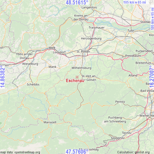
Eschenau GPS coordinates[2]
48° 2' 53.7" North, 15° 34' 0.984" East
| Map corner | latitude | longitude |
|---|---|---|
| Upper-left | 48.51615°, | 14.86382° |
| Center: | 48.04825°, | 15.56694° |
| Lower-right: | 47.57606°, | 16.27007° |
| Map W x H: | 104.5×104.5 km | = 64.9×64.9mi |
| max Lat: | 48.98333° ⇑30.5% North |
| Eschenau: | 48.04825° |
| min Lat: | ⇓69.5% South 46.48841° |
| min Long | Eschenau | max Long |
| 9.57802° | 15.56694° | 17.1° |
| W 67.5%⇐ | ⇒32.5% E |
Elevation
Elevation of Eschenau is 394 m = 1293 ft, and this is 111.5 m = 366 ft below average elevation for this country.
| Max E: |
2140 m = 7021 ft | 58.5% |
| Avg. | 505.5 m = 1658 ft | |
| Eschenau | 394 m = 1293 ft | |
Min E: |
118 m = 387 ft | 41.5% |
See also: Austria elevation on elevation.city.
Geographical zone
Eschenau is located in North temperate zone (between Tropic of Cancer and the Arctic Circle). Distance of this North polar circle is 2058.7 km =1279.2 mi to North.| Distance of | km | miles | from Eschenau |
|---|---|---|---|
| North Pole | 4664.6 | 2898.4 | to North |
| Arctic Circle | 2058.7 | 1279.2 | to North |
| Tropic Cancer | 2736.5 | 1700.4 | to South |
| Equator | 5342.5 | 3319.7 | to South |


Nearby cities:
15 places around Eschenau: (largest is in red/bold)
• Dorf Au
7.9 km =4.9 mi,  285°
285°
• Eggendorf
10 km =6.2 mi,  22°
22°
• Hofstetten
6.8 km =4.2 mi,  322°
322°
• Kirchberg an der Pielach
10.5 km =6.5 mi,  256°
256°
• Lilienfeld
4.5 km =2.8 mi,  150°
150°
• Marktl
3.8 km =2.4 mi,  135°
135°
• Rabenstein an der Pielach
7.6 km =4.7 mi,  284°
284°
• Rotheau
3.2 km =2 mi,  46°
46°
• Sankt Veit an der Gölsen
7.6 km =4.7 mi,  94°
94°
• Soisgegend
10.3 km =6.4 mi,  232°
232°
• Stangental
4.4 km =2.7 mi,  166°
166°
• Steinwandleiten
5.3 km =3.3 mi,  67°
67°
• Traisen
3 km =1.9 mi,  124°
124°
• Weinburg
7.7 km =4.8 mi,  340°
340°
• Wilhelmsburg
7 km =4.3 mi, 24°
Sources, notices
• [Note1] Compared only with cities in Austria existing in our database
• [Src1] Map data: © OpenStreetMap contributors (CC-BY-SA)
• [Src2] Other city data from geonames.org with taken over terms of usage.
• [Src3] Geographical zone / Annual Mean Temperature by Robert A. Rohde @ Wikipedia
