Steinwandleiten geodata
Steinwandleiten (Lower Austria) is a populated locality; located in Austria in Europe/Vienna (GMT+2) time zone. With population of 515 people, there are 2448 cities with bigger population in this country. Compared to other cities in Austria, 70.4% of cities are located further ↓South; 69.9% of cities are located further ←West and 73.7% of cities have lower elevation than Steinwandleiten. Note1
Administrative division(s):
- Level 1: Lower Austria
- Level 2: Politischer Bezirk Lilienfeld
- Level 3: Sankt Veit an der Gölsen


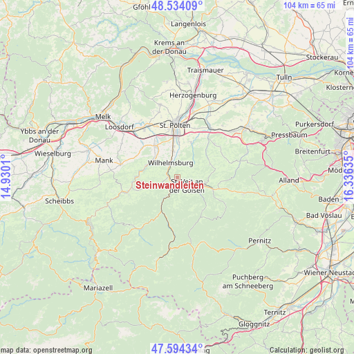
Steinwandleiten GPS coordinates[2]
48° 3' 58.896" North, 15° 37' 59.592" East
| Map corner | latitude | longitude |
|---|---|---|
| Upper-left | 48.53409°, | 14.9301° |
| Center: | 48.06636°, | 15.63322° |
| Lower-right: | 47.59434°, | 16.33635° |
| Map W x H: | 104.5×104.5 km | = 64.9×64.9mi |
| max Lat: | 48.98333° ⇑29.6% North |
| Steinwandleiten: | 48.06636° |
| min Lat: | ⇓70.4% South 46.48841° |
| min Long | Steinwandleiten | max Long |
| 9.57802° | 15.63322° | 17.1° |
| W 69.9%⇐ | ⇒30.1% E |
Elevation
Elevation of Steinwandleiten is 635 m = 2083 ft, and this is 129.5 m = 425 ft above average elevation for this country.
| Max E: |
2140 m = 7021 ft | 26.3% |
| Steinwandleiten | 635 m 2083 ft | |
| Avg. | 505.5 m = 1658 ft | |
Min E: |
118 m = 387 ft | 73.7% |
See also: Austria elevation on elevation.city.
Geographical zone
Steinwandleiten is located in North temperate zone (between Tropic of Cancer and the Arctic Circle). Distance of this North polar circle is 2056.7 km =1278 mi to North.| Distance of | km | miles | from Steinwandleiten |
|---|---|---|---|
| North Pole | 4662.6 | 2897.2 | to North |
| Arctic Circle | 2056.7 | 1278 | to North |
| Tropic Cancer | 2738.6 | 1701.7 | to South |
| Equator | 5344.5 | 3320.9 | to South |


Nearby cities:
15 places around Steinwandleiten: (largest is in red/bold)
• Eggendorf
7.3 km =4.5 mi,  352°
352°
• Eschenau
5.3 km =3.3 mi,  247°
247°
• Gölsen
8.6 km =5.3 mi,  108°
108°
• Hofstetten
9.7 km =6 mi,  290°
290°
• Lilienfeld
6.5 km =4 mi,  204°
204°
• Marktl
5.3 km =3.3 mi,  205°
205°
• Mühlgang
8.4 km =5.2 mi, 350°
• Rainfeld
6.1 km =3.8 mi, 110°
• Rohrbach an der Gölsen
8.3 km =5.2 mi,  104°
104°
• Rotheau
2.6 km =1.6 mi,  274°
274°
• Sankt Veit an der Gölsen
3.7 km =2.3 mi,  133°
133°
• Stangental
7.4 km =4.6 mi, 211°
• Traisen
4.4 km =2.7 mi, 213°
• Weinburg
9.1 km =5.7 mi,  305°
305°
• Wilhelmsburg
4.8 km =3 mi,  334°
334°
Sources, notices
• [Note1] Compared only with cities in Austria existing in our database
• [Src1] Map data: © OpenStreetMap contributors (CC-BY-SA)
• [Src2] Other city data from geonames.org with taken over terms of usage.
• [Src3] Geographical zone / Annual Mean Temperature by Robert A. Rohde @ Wikipedia
