Eggendorf geodata
Eggendorf (Lower Austria) is a populated place; located in Austria in Europe/Vienna (GMT+2) time zone. With population of 1,191 people, there are 1055 cities with bigger population in this country. Compared to other cities in Austria, 74.4% of cities are located further ↓South; 69.6% of cities are located further ←West and 74.6% of cities have higher elevation than Eggendorf. Note1


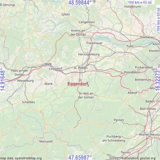
Eggendorf GPS coordinates[2]
48° 7' 52.68" North, 15° 37' 10.56" East
| Map corner | latitude | longitude |
|---|---|---|
| Upper-left | 48.59844°, | 14.91648° |
| Center: | 48.1313°, | 15.6196° |
| Lower-right: | 47.65987°, | 16.32273° |
| Map W x H: | 104.4×104.4 km | = 64.9×64.9mi |
| max Lat: | 48.98333° ⇑25.6% North |
| Eggendorf: | 48.1313° |
| min Lat: | ⇓74.4% South 46.48841° |
| min Long | Eggendorf | max Long |
| 9.57802° | 15.6196° | 17.1° |
| W 69.6%⇐ | ⇒30.4% E |
Elevation
Elevation of Eggendorf is 306 m = 1004 ft, and this is 199.5 m = 655 ft below average elevation for this country.
| Max E: |
2140 m = 7021 ft | 74.6% |
| Avg. | 505.5 m = 1658 ft | |
| Eggendorf | 306 m = 1004 ft | |
Min E: |
118 m = 387 ft | 25.4% |
See also: Austria elevation on elevation.city.
Geographical zone
Eggendorf is located in North temperate zone (between Tropic of Cancer and the Arctic Circle). Distance of this North polar circle is 2049.5 km =1273.5 mi to North.| Distance of | km | miles | from Eggendorf |
|---|---|---|---|
| North Pole | 4655.4 | 2892.7 | to North |
| Arctic Circle | 2049.5 | 1273.5 | to North |
| Tropic Cancer | 2745.8 | 1706.2 | to South |
| Equator | 5351.7 | 3325.4 | to South |


Nearby cities:
15 places around Eggendorf: (largest is in red/bold)
• Harland
3.6 km =2.2 mi,  22°
22°
• Hart
2.5 km =1.6 mi,  353°
353°
• Hofstetten
8.9 km =5.5 mi,  244°
244°
• Mühlgang
1.1 km =0.7 mi,  343°
343°
• Ober-Grafendorf
5.9 km =3.7 mi,  291°
291°
• Oberwagram
8.1 km =5 mi, 15°
• Pyhra
5.8 km =3.6 mi,  57°
57°
• Rotheau
7.2 km =4.5 mi,  192°
192°
• Sankt Pölten
7.7 km =4.8 mi,  7°
7°
• Spratzern
4.4 km =2.7 mi,  358°
358°
• Stattersdorf
5.9 km =3.7 mi, 9°
• Steinwandleiten
7.3 km =4.5 mi,  172°
172°
• Teufelhof
5.8 km =3.6 mi, 357°
• Weinburg
6.7 km =4.2 mi,  252°
252°
• Wilhelmsburg
3 km =1.9 mi,  200°
200°
Sources, notices
• [Note1] Compared only with cities in Austria existing in our database
• [Src1] Map data: © OpenStreetMap contributors (CC-BY-SA)
• [Src2] Other city data from geonames.org with taken over terms of usage.
• [Src3] Geographical zone / Annual Mean Temperature by Robert A. Rohde @ Wikipedia
