Weinburg geodata
Weinburg (Lower Austria) is a seat of a third-order administrative division; located in Austria in Europe/Vienna (GMT+2) time zone. With population of 708 people, there are 1836 cities with bigger population in this country. Compared to other cities in Austria, 73.4% of cities are located further ↓South; 66.4% of cities are located further ←West and 74.6% of cities have higher elevation than Weinburg. Note1
Administrative division(s):
- Level 1: Lower Austria
- Level 2: Politischer Bezirk Sankt Pölten
- Level 3: Weinburg


Weinburg GPS coordinates[2]
48° 6' 48.636" North, 15° 31' 58.62" East
| Map corner | latitude | longitude |
|---|---|---|
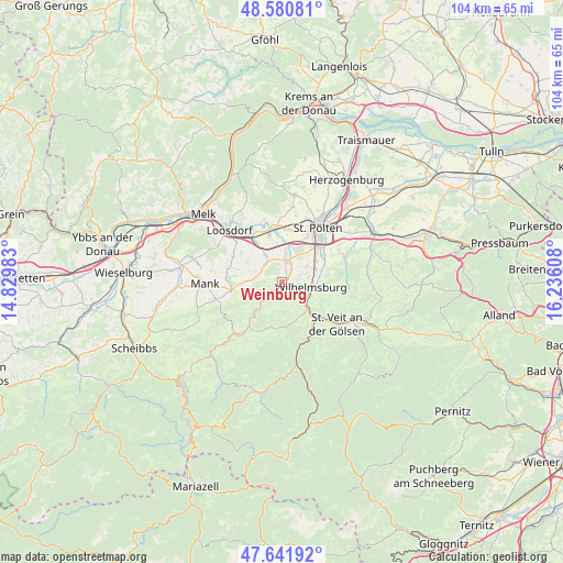
| Upper-left | 48.58081°, | 14.82983° |
| Center: | 48.11351°, | 15.53295° |
| Lower-right: | 47.64192°, | 16.23608° |
| Map W x H: | 104.4×104.4 km | = 64.9×64.9mi |
| max Lat: | 48.98333° ⇑26.6% North |
| Weinburg: | 48.11351° |
| min Lat: | ⇓73.4% South 46.48841° |
| min Long | Weinburg | max Long |
| 9.57802° | 15.53295° | 17.1° |
| W 66.4%⇐ | ⇒33.6% E |
Elevation
Elevation of Weinburg is 306 m = 1004 ft, and this is 199.5 m = 655 ft below average elevation for this country.
| Max E: |
2140 m = 7021 ft | 74.6% |
| Avg. | 505.5 m = 1658 ft | |
| Weinburg | 306 m = 1004 ft | |
Min E: |
118 m = 387 ft | 25.4% |
See also: Austria elevation on elevation.city.
Geographical zone
Weinburg is located in North temperate zone (between Tropic of Cancer and the Arctic Circle). Distance of this North polar circle is 2051.5 km =1274.7 mi to North.| Distance of | km | miles | from Weinburg |
|---|---|---|---|
| North Pole | 4657.3 | 2893.9 | to North |
| Arctic Circle | 2051.5 | 1274.7 | to North |
| Tropic Cancer | 2743.8 | 1704.9 | to South |
| Equator | 5349.7 | 3324.1 | to South |


Nearby cities:
15 places around Weinburg: (largest is in red/bold)
• Bischofstetten
4.8 km =3 mi,  281°
281°
• Dorf Au
7.3 km =4.5 mi,  224°
224°
• Eggendorf
6.7 km =4.2 mi,  72°
72°
• Eschenau
7.7 km =4.8 mi,  160°
160°
• Hart
7.6 km =4.7 mi,  54°
54°
• Hofstetten
2.4 km =1.5 mi, 221°
• Markersdorf an der Pielach
8.1 km =5 mi,  342°
342°
• Mühlgang
6.8 km =4.2 mi,  63°
63°
• Ober-Grafendorf
4.2 km =2.6 mi,  12°
12°
• Rabenstein an der Pielach
7.2 km =4.5 mi, 222°
• Rotheau
7 km =4.3 mi,  136°
136°
• Sankt Margarethen an der Sierning
6 km =3.7 mi,  328°
328°
• Spratzern
9 km =5.6 mi, 45°
• Steinwandleiten
9.1 km =5.7 mi,  125°
125°
• Wilhelmsburg
5.4 km =3.4 mi,  99°
99°
Sources, notices
• [Note1] Compared only with cities in Austria existing in our database
• [Src1] Map data: © OpenStreetMap contributors (CC-BY-SA)
• [Src2] Other city data from geonames.org with taken over terms of usage.
• [Src3] Geographical zone / Annual Mean Temperature by Robert A. Rohde @ Wikipedia
