Ernstbrunn geodata
Ernstbrunn (Lower Austria) is a seat of a third-order administrative division; located in Austria in Europe/Vienna (GMT+2) time zone. With population of 1,536 people, there are 819 cities with bigger population in this country. Compared to other cities in Austria, 95.1% of cities are located further ↓South; 89.9% of cities are located further ←West and 65.5% of cities have higher elevation than Ernstbrunn. Note1
Administrative division(s):
- Level 1: Lower Austria
- Level 2: Politischer Bezirk Korneuburg
- Level 3: Ernstbrunn


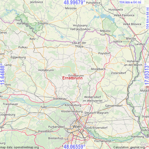
Ernstbrunn GPS coordinates[2]
48° 31' 59.988" North, 16° 21' 0" East
| Map corner | latitude | longitude |
|---|---|---|
| Upper-left | 48.99679°, | 15.64688° |
| Center: | 48.53333°, | 16.35° |
| Lower-right: | 48.06559°, | 17.05313° |
| Map W x H: | 103.5×103.5 km | = 64.3×64.3mi |
| max Lat: | 48.98333° ⇑4.9% North |
| Ernstbrunn: | 48.53333° |
| min Lat: | ⇓95.1% South 46.48841° |
| min Long | Ernstbrunn | max Long |
| 9.57802° | 16.35° | 17.1° |
| W 89.9%⇐ | ⇒10.1% E |
Elevation
Elevation of Ernstbrunn is 352 m = 1155 ft, and this is 153.5 m = 504 ft below average elevation for this country.
| Max E: |
2140 m = 7021 ft | 65.5% |
| Avg. | 505.5 m = 1658 ft | |
| Ernstbrunn | 352 m = 1155 ft | |
Min E: |
118 m = 387 ft | 34.5% |
See also: Austria elevation on elevation.city.
Geographical zone
Ernstbrunn is located in North temperate zone (between Tropic of Cancer and the Arctic Circle). Distance of this North polar circle is 2004.8 km =1245.7 mi to North.| Distance of | km | miles | from Ernstbrunn |
|---|---|---|---|
| North Pole | 4610.7 | 2865 | to North |
| Arctic Circle | 2004.8 | 1245.7 | to North |
| Tropic Cancer | 2790.5 | 1733.9 | to South |
| Equator | 5396.4 | 3353.2 | to South |


Nearby cities:
15 places around Ernstbrunn: (largest is in red/bold)
• Asparn an der Zaya
12.4 km =7.7 mi,  63°
63°
• Fallbach
13.9 km =8.6 mi,  20°
20°
• Gaubitsch
13.2 km =8.2 mi,  10°
10°
• Gnadendorf
10 km =6.2 mi, 21°
• Großmugl
9.6 km =6 mi,  246°
246°
• Großrußbach
8.2 km =5.1 mi,  143°
143°
• Hüttendorf
13.6 km =8.5 mi,  82°
82°
• Kreuzstetten
10.8 km =6.7 mi,  122°
122°
• Ladendorf
9.8 km =6.1 mi,  90°
90°
• Niederhollabrunn
11.7 km =7.3 mi,  198°
198°
• Niederkreuzstetten
11.3 km =7 mi, 123°
• Niederleis
4.1 km =2.5 mi, 63°
• Obergänserndorf
13 km =8.1 mi,  174°
174°
• Paasdorf
13.5 km =8.4 mi, 90°
• Stronsdorf
13.7 km =8.5 mi,  344°
344°
Sources, notices
• [Note1] Compared only with cities in Austria existing in our database
• [Src1] Map data: © OpenStreetMap contributors (CC-BY-SA)
• [Src2] Other city data from geonames.org with taken over terms of usage.
• [Src3] Geographical zone / Annual Mean Temperature by Robert A. Rohde @ Wikipedia
