Gnadendorf geodata
Gnadendorf (Lower Austria) is a seat of a third-order administrative division; located in Austria in Europe/Vienna (GMT+2) time zone. With population of 258 people, there are 2797 cities with bigger population in this country. Compared to other cities in Austria, 96.9% of cities are located further ↓South; 91.2% of cities are located further ←West and 85.6% of cities have higher elevation than Gnadendorf. Note1
Administrative division(s):
- Level 1: Lower Austria
- Level 2: Politischer Bezirk Mistelbach
- Level 3: Gnadendorf


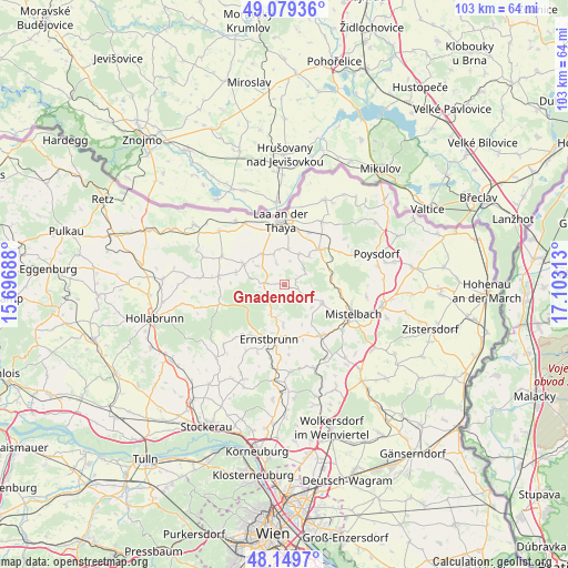
Gnadendorf GPS coordinates[2]
48° 37' 0.012" North, 16° 24' 0" East
| Map corner | latitude | longitude |
|---|---|---|
| Upper-left | 49.07936°, | 15.69688° |
| Center: | 48.61667°, | 16.4° |
| Lower-right: | 48.1497°, | 17.10313° |
| Map W x H: | 103.4×103.4 km | = 64.2×64.2mi |
| max Lat: | 48.98333° ⇑3.1% North |
| Gnadendorf: | 48.61667° |
| min Lat: | ⇓96.9% South 46.48841° |
| min Long | Gnadendorf | max Long |
| 9.57802° | 16.4° | 17.1° |
| W 91.2%⇐ | ⇒8.8% E |
Elevation
Elevation of Gnadendorf is 244 m = 801 ft, and this is 261.5 m = 858 ft below average elevation for this country.
| Max E: |
2140 m = 7021 ft | 85.6% |
| Avg. | 505.5 m = 1658 ft | |
| Gnadendorf | 244 m = 801 ft | |
Min E: |
118 m = 387 ft | 14.4% |
See also: Austria elevation on elevation.city.
Geographical zone
Gnadendorf is located in North temperate zone (between Tropic of Cancer and the Arctic Circle). Distance of this North polar circle is 1995.5 km =1239.9 mi to North.| Distance of | km | miles | from Gnadendorf |
|---|---|---|---|
| North Pole | 4601.4 | 2859.2 | to North |
| Arctic Circle | 1995.5 | 1239.9 | to North |
| Tropic Cancer | 2799.7 | 1739.7 | to South |
| Equator | 5405.7 | 3358.9 | to South |


Nearby cities:
15 places around Gnadendorf: (largest is in red/bold)
• Asparn an der Zaya
8.2 km =5.1 mi,  116°
116°
• Ernstbrunn
10 km =6.2 mi,  201°
201°
• Fallbach
3.9 km =2.4 mi,  18°
18°
• Gaubitsch
3.9 km =2.4 mi,  341°
341°
• Großharras
12.5 km =7.8 mi,  294°
294°
• Hanfthal
9.6 km =6 mi,  345°
345°
• Hüttendorf
12.3 km =7.6 mi,  127°
127°
• Kautendorf
8.3 km =5.2 mi,  47°
47°
• Laa an der Thaya
11.2 km =7 mi, 353°
• Ladendorf
11.1 km =6.9 mi,  146°
146°
• Niederleis
7.4 km =4.6 mi,  180°
180°
• Siebenhirten
10 km =6.2 mi,  100°
100°
• Staatz
9.2 km =5.7 mi,  44°
44°
• Stronsdorf
8.4 km =5.2 mi,  297°
297°
• Unterstinkenbrunn
6.9 km =4.3 mi,  325°
325°
Sources, notices
• [Note1] Compared only with cities in Austria existing in our database
• [Src1] Map data: © OpenStreetMap contributors (CC-BY-SA)
• [Src2] Other city data from geonames.org with taken over terms of usage.
• [Src3] Geographical zone / Annual Mean Temperature by Robert A. Rohde @ Wikipedia
