Dürnkrut geodata
Dürnkrut (Lower Austria) is a seat of a third-order administrative division; located in Austria in Europe/Vienna (GMT+2) time zone. With population of 1,750 people, there are 714 cities with bigger population in this country. Compared to other cities in Austria, 93.6% of cities are located further ↓South; 98.8% of cities are located further ←West and 98.2% of cities have higher elevation than Dürnkrut. Note1
Administrative division(s):
- Level 1: Lower Austria
- Level 2: Politischer Bezirk Gänserndorf
- Level 3: Dürnkrut


Dürnkrut GPS coordinates[2]
48° 28' 23.34" North, 16° 51' 2.232" East
| Map corner | latitude | longitude |
|---|---|---|
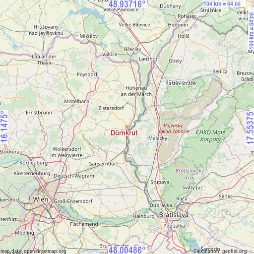
| Upper-left | 48.93716°, | 16.1475° |
| Center: | 48.47315°, | 16.85062° |
| Lower-right: | 48.00486°, | 17.55375° |
| Map W x H: | 103.7×103.7 km | = 64.4×64.4mi |
| max Lat: | 48.98333° ⇑6.4% North |
| Dürnkrut: | 48.47315° |
| min Lat: | ⇓93.6% South 46.48841° |
| min Long | Dürnkrut | max Long |
| 9.57802° | 16.85062° | 17.1° |
| W 98.8%⇐ | ⇒1.2% E |
Elevation
Elevation of Dürnkrut is 152 m = 499 ft, and this is 353.5 m = 1160 ft below average elevation for this country.
| Max E: |
2140 m = 7021 ft | 98.2% |
| Avg. | 505.5 m = 1658 ft | |
| Dürnkrut | 152 m = 499 ft | |
Min E: |
118 m = 387 ft | 1.8% |
See also: Austria elevation on elevation.city.
Geographical zone
Dürnkrut is located in North temperate zone (between Tropic of Cancer and the Arctic Circle). Distance of this North polar circle is 2011.5 km =1249.9 mi to North.| Distance of | km | miles | from Dürnkrut |
|---|---|---|---|
| North Pole | 4617.4 | 2869.1 | to North |
| Arctic Circle | 2011.5 | 1249.9 | to North |
| Tropic Cancer | 2783.8 | 1729.8 | to South |
| Equator | 5389.7 | 3349 | to South |


Nearby cities:
15 places around Dürnkrut: (largest is in red/bold)
• Angern an der March
10.7 km =6.6 mi,  188°
188°
• Drösing
8.3 km =5.2 mi,  27°
27°
• Ebenthal
6.7 km =4.2 mi,  228°
228°
• Groß-Inzersdorf
8.9 km =5.5 mi,  311°
311°
• Jedenspeigen
3.2 km =2 mi, 29°
• Loidesthal
7.5 km =4.7 mi,  278°
278°
• Matzen
13.8 km =8.6 mi, 233°
• Niederabsdorf
10.4 km =6.5 mi,  359°
359°
• Ollersdorf
8.9 km =5.5 mi,  204°
204°
• Palterndorf
12.5 km =7.8 mi,  348°
348°
• Prottes
12.7 km =7.9 mi,  220°
220°
• Ringelsdorf
10.5 km =6.5 mi,  6°
6°
• Spannberg
8.5 km =5.3 mi,  263°
263°
• Waidendorf
2.2 km =1.4 mi,  245°
245°
• Zistersdorf
10.1 km =6.3 mi,  319°
319°
Sources, notices
• [Note1] Compared only with cities in Austria existing in our database
• [Src1] Map data: © OpenStreetMap contributors (CC-BY-SA)
• [Src2] Other city data from geonames.org with taken over terms of usage.
• [Src3] Geographical zone / Annual Mean Temperature by Robert A. Rohde @ Wikipedia
