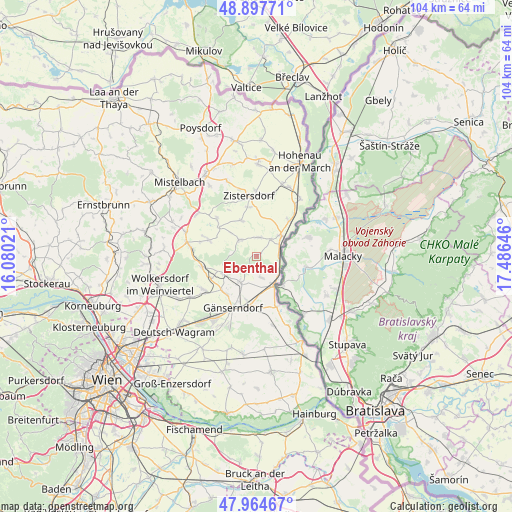
Ebenthal geodata
Ebenthal (Lower Austria) is a seat of a third-order administrative division; located in Austria in Europe/Vienna (GMT+2) time zone. With population of 923 people, there are 1393 cities with bigger population in this country. Compared to other cities in Austria, 91.9% of cities are located further ↓South; 98.1% of cities are located further ←West and 94.4% of cities have higher elevation than Ebenthal. Note1
Administrative division(s):
- Level 1: Lower Austria
- Level 2: Politischer Bezirk Gänserndorf
- Level 3: Ebenthal


Ebenthal GPS coordinates[2]
48° 25' 59.988" North, 16° 46' 59.988" East
| Map corner | latitude | longitude |
|---|---|---|
| Upper-left | 48.89771°, | 16.08021° |
| Center: | 48.43333°, | 16.78333° |
| Lower-right: | 47.96467°, | 17.48646° |
| Map W x H: | 103.7×103.7 km | = 64.4×64.4mi |
| max Lat: | 48.98333° ⇑8.1% North |
| Ebenthal: | 48.43333° |
| min Lat: | ⇓91.9% South 46.48841° |
| min Long | Ebenthal | max Long |
| 9.57802° | 16.78333° | 17.1° |
| W 98.1%⇐ | ⇒1.9% E |
Elevation
Elevation of Ebenthal is 182 m = 597 ft, and this is 323.5 m = 1061 ft below average elevation for this country.
| Max E: |
2140 m = 7021 ft | 94.4% |
| Avg. | 505.5 m = 1658 ft | |
| Ebenthal | 182 m = 597 ft | |
Min E: |
118 m = 387 ft | 5.6% |
See also: Austria elevation on elevation.city.
Geographical zone
Ebenthal is located in North temperate zone (between Tropic of Cancer and the Arctic Circle). Distance of this North polar circle is 2015.9 km =1252.6 mi to North.| Distance of | km | miles | from Ebenthal |
|---|---|---|---|
| North Pole | 4621.8 | 2871.9 | to North |
| Arctic Circle | 2015.9 | 1252.6 | to North |
| Tropic Cancer | 2779.4 | 1727 | to South |
| Equator | 5385.3 | 3346.3 | to South |


Nearby cities:
15 places around Ebenthal: (largest is in red/bold)
• Angern an der March
7 km =4.3 mi,  151°
151°
• Dürnkrut
6.7 km =4.2 mi,  48°
48°
• Groß-Inzersdorf
10.5 km =6.5 mi,  350°
350°
• Groß-Schweinbarth
11.4 km =7.1 mi,  259°
259°
• Hohenruppersdorf
10.3 km =6.4 mi,  289°
289°
• Jedenspeigen
9.7 km =6 mi,  42°
42°
• Loidesthal
6.1 km =3.8 mi,  336°
336°
• Matzen
7.2 km =4.5 mi,  238°
238°
• Ollersdorf
3.9 km =2.4 mi,  161°
161°
• Prottes
6.1 km =3.8 mi,  212°
212°
• Raggendorf
10.2 km =6.3 mi, 244°
• Schönkirchen-Reyersdorf
11.1 km =6.9 mi,  217°
217°
• Spannberg
4.8 km =3 mi,  314°
314°
• Waidendorf
4.6 km =2.9 mi, 40°
• Weikendorf
10 km =6.2 mi,  187°
187°
Sources, notices
• [Note1] Compared only with cities in Austria existing in our database
• [Src1] Map data: © OpenStreetMap contributors (CC-BY-SA)
• [Src2] Other city data from geonames.org with taken over terms of usage.
• [Src3] Geographical zone / Annual Mean Temperature by Robert A. Rohde @ Wikipedia
