Burgfried geodata
Burgfried (Salzburg) is a populated place; located in Austria in Europe/Vienna (GMT+2) time zone. With population of 3,358 people, there are 325 cities with bigger population in this country. Compared to other cities in Austria, 52.7% of cities are located further ↓South; 81.1% of cities are located further →East and 50.5% of cities have higher elevation than Burgfried. Note1


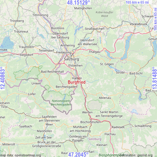
Burgfried GPS coordinates[2]
47° 40' 48.144" North, 13° 6' 42.3" East
| Map corner | latitude | longitude |
|---|---|---|
| Upper-left | 48.15129°, | 12.40863° |
| Center: | 47.68004°, | 13.11175° |
| Lower-right: | 47.2045°, | 13.81488° |
| Map W x H: | 105.3×105.3 km | = 65.4×65.4mi |
| max Lat: | 48.98333° ⇑47.3% North |
| Burgfried: | 47.68004° |
| min Lat: | ⇓52.7% South 46.48841° |
| min Long | Burgfried | max Long |
| 9.57802° | 13.11175° | 17.1° |
| W 18.9%⇐ | ⇒81.1% E |
Elevation
Elevation of Burgfried is 448 m = 1470 ft, and this is 57.5 m = 189 ft below average elevation for this country.
| Max E: |
2140 m = 7021 ft | 50.5% |
| Avg. | 505.5 m = 1658 ft | |
| Burgfried | 448 m = 1470 ft | |
Min E: |
118 m = 387 ft | 49.5% |
See also: Austria elevation on elevation.city.
Geographical zone
Burgfried is located in North temperate zone (between Tropic of Cancer and the Arctic Circle). Distance of this North polar circle is 2099.7 km =1304.7 mi to North.| Distance of | km | miles | from Burgfried |
|---|---|---|---|
| North Pole | 4705.5 | 2923.9 | to North |
| Arctic Circle | 2099.7 | 1304.7 | to North |
| Tropic Cancer | 2695.6 | 1675 | to South |
| Equator | 5301.5 | 3294.2 | to South |


Nearby cities:
15 places around Burgfried: (largest is in red/bold)
• Adnet
2.4 km =1.5 mi,  36°
36°
• Au
4 km =2.5 mi,  303°
303°
• Bad Dürrnberg
2.3 km =1.4 mi,  224°
224°
• Garnei
3.8 km =2.4 mi,  158°
158°
• Georgenberg
5.9 km =3.7 mi,  151°
151°
• Hallein
1 km =0.6 mi,  292°
292°
• Jadorf
5.4 km =3.4 mi, 149°
• Kuchl
6.5 km =4 mi, 157°
• Neualm
2.3 km =1.4 mi,  309°
309°
• Oberalm
2.4 km =1.5 mi,  338°
338°
• Puch bei Hallein
4.2 km =2.6 mi, 340°
• Taxach
5.9 km =3.7 mi,  329°
329°
• Vigaun
2.2 km =1.4 mi,  132°
132°
• Waidach
2.2 km =1.4 mi,  63°
63°
• Wimberg
5.1 km =3.2 mi, 35°
Sources, notices
• [Note1] Compared only with cities in Austria existing in our database
• [Src1] Map data: © OpenStreetMap contributors (CC-BY-SA)
• [Src2] Other city data from geonames.org with taken over terms of usage.
• [Src3] Geographical zone / Annual Mean Temperature by Robert A. Rohde @ Wikipedia
