Waidach geodata
Waidach (Salzburg) is a populated place; located in Austria in Europe/Vienna (GMT+2) time zone. With population of 856 people, there are 1508 cities with bigger population in this country. Compared to other cities in Austria, 52.9% of cities are located further ↓South; 80.4% of cities are located further →East and 55.9% of cities have lower elevation than Waidach. Note1


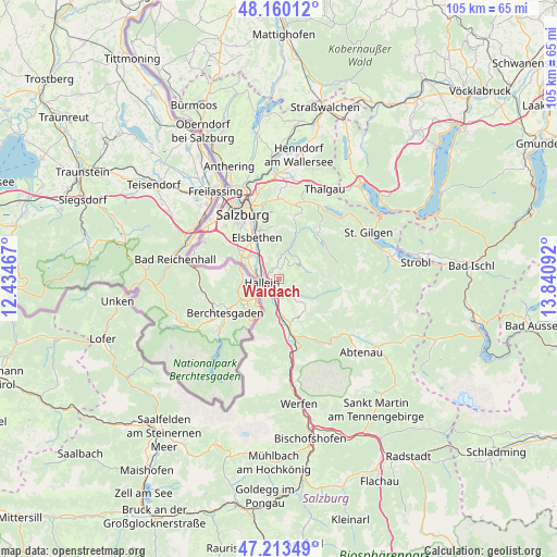
Waidach GPS coordinates[2]
47° 41' 20.22" North, 13° 8' 16.044" East
| Map corner | latitude | longitude |
|---|---|---|
| Upper-left | 48.16012°, | 12.43467° |
| Center: | 47.68895°, | 13.13779° |
| Lower-right: | 47.21349°, | 13.84092° |
| Map W x H: | 105.3×105.3 km | = 65.4×65.4mi |
| max Lat: | 48.98333° ⇑47.1% North |
| Waidach: | 47.68895° |
| min Lat: | ⇓52.9% South 46.48841° |
| min Long | Waidach | max Long |
| 9.57802° | 13.13779° | 17.1° |
| W 19.6%⇐ | ⇒80.4% E |
Elevation
Elevation of Waidach is 491 m = 1611 ft, and this is 14.5 m = 48 ft below average elevation for this country.
| Max E: |
2140 m = 7021 ft | 44.1% |
| Avg. | 505.5 m = 1658 ft | |
| Waidach | 491 m = 1611 ft | |
Min E: |
118 m = 387 ft | 55.9% |
See also: Austria elevation on elevation.city.
Geographical zone
Waidach is located in North temperate zone (between Tropic of Cancer and the Arctic Circle). Distance of this North polar circle is 2098.7 km =1304.1 mi to North.| Distance of | km | miles | from Waidach |
|---|---|---|---|
| North Pole | 4704.5 | 2923.2 | to North |
| Arctic Circle | 2098.7 | 1304.1 | to North |
| Tropic Cancer | 2696.6 | 1675.6 | to South |
| Equator | 5302.5 | 3294.8 | to South |


Nearby cities:
15 places around Waidach: (largest is in red/bold)
• Adnet
1.1 km =0.7 mi,  332°
332°
• Au
5.5 km =3.4 mi,  282°
282°
• Bad Dürrnberg
4.5 km =2.8 mi,  233°
233°
• Burgfried
2.2 km =1.4 mi,  243°
243°
• Gaißau
5.1 km =3.2 mi,  61°
61°
• Garnei
4.6 km =2.9 mi,  186°
186°
• Georgenberg
6.3 km =3.9 mi,  171°
171°
• Hallein
2.9 km =1.8 mi,  257°
257°
• Jadorf
5.7 km =3.5 mi, 172°
• Krispl
4.6 km =2.9 mi,  47°
47°
• Neualm
3.8 km =2.4 mi, 277°
• Oberalm
3.1 km =1.9 mi,  293°
293°
• Puch bei Hallein
4.5 km =2.8 mi,  311°
311°
• Vigaun
2.5 km =1.6 mi, 187°
• Wimberg
3.3 km =2.1 mi,  18°
18°
Sources, notices
• [Note1] Compared only with cities in Austria existing in our database
• [Src1] Map data: © OpenStreetMap contributors (CC-BY-SA)
• [Src2] Other city data from geonames.org with taken over terms of usage.
• [Src3] Geographical zone / Annual Mean Temperature by Robert A. Rohde @ Wikipedia
