Bischofshofen geodata
Bischofshofen (Salzburg) is a seat of a third-order administrative division; located in Austria in Europe/Vienna (GMT+2) time zone. With population of 7,457 people, there are 121 cities with bigger population in this country. Compared to other cities in Austria, 58.7% of cities are located further ↑North; 78.8% of cities are located further →East and 65.9% of cities have lower elevation than Bischofshofen. Note1
Administrative division(s):
- Level 1: Salzburg
- Level 2: Politischer Bezirk Sankt Johann im Pongau
- Level 3: Bischofshofen


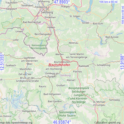
Bischofshofen GPS coordinates[2]
47° 25' 0.012" North, 13° 13' 0.012" East
| Map corner | latitude | longitude |
|---|---|---|
| Upper-left | 47.8903°, | 12.51355° |
| Center: | 47.41667°, | 13.21667° |
| Lower-right: | 46.93874°, | 13.9198° |
| Map W x H: | 105.8×105.8 km | = 65.7×65.7mi |
| max Lat: | 48.98333° ⇑58.7% North |
| Bischofshofen: | 47.41667° |
| min Lat: | ⇓41.3% South 46.48841° |
| min Long | Bischofshofen | max Long |
| 9.57802° | 13.21667° | 17.1° |
| W 21.2%⇐ | ⇒78.8% E |
Elevation
Elevation of Bischofshofen is 558 m = 1831 ft, and this is 52.5 m = 172 ft above average elevation for this country.
| Max E: |
2140 m = 7021 ft | 34.1% |
| Bischofshofen | 558 m 1831 ft | |
| Avg. | 505.5 m = 1658 ft | |
Min E: |
118 m = 387 ft | 65.9% |
See also: Austria elevation on elevation.city.
Geographical zone
Bischofshofen is located in North temperate zone (between Tropic of Cancer and the Arctic Circle). Distance of this North polar circle is 2128.9 km =1322.8 mi to North.| Distance of | km | miles | from Bischofshofen |
|---|---|---|---|
| North Pole | 4734.8 | 2942.1 | to North |
| Arctic Circle | 2128.9 | 1322.8 | to North |
| Tropic Cancer | 2666.3 | 1656.8 | to South |
| Equator | 5272.2 | 3276 | to South |


Nearby cities:
15 places around Bischofshofen: (largest is in red/bold)
• Dorfwerfen
4.7 km =2.9 mi,  350°
350°
• Hüttau
6.9 km =4.3 mi,  90°
90°
• Laideregg
1.3 km =0.8 mi,  270°
270°
• Maschl
5.7 km =3.5 mi,  192°
192°
• Mitterberghütten
1.9 km =1.2 mi,  180°
180°
• Mühlbach am Hochkönig
7.9 km =4.9 mi,  236°
236°
• Pfarrwerfen
4.6 km =2.9 mi, 349°
• Plankenau
10.2 km =6.3 mi, 190°
• Reinbach
8 km =5 mi, 194°
• Rettenstein
7.4 km =4.6 mi, 180°
• Sankt Johann im Pongau
7.5 km =4.7 mi, 189°
• Sonnberg
7.5 km =4.7 mi, 90°
• Sulzau
10 km =6.2 mi,  337°
337°
• Werfen
6.9 km =4.3 mi, 343°
• Werfenweng
5.8 km =3.6 mi,  30°
30°
Sources, notices
• [Note1] Compared only with cities in Austria existing in our database
• [Src1] Map data: © OpenStreetMap contributors (CC-BY-SA)
• [Src2] Other city data from geonames.org with taken over terms of usage.
• [Src3] Geographical zone / Annual Mean Temperature by Robert A. Rohde @ Wikipedia
