Werfenweng geodata
Werfenweng (Salzburg) is a seat of a third-order administrative division; located in Austria in Europe/Vienna (GMT+2) time zone. With population of 694 people, there are 1872 cities with bigger population in this country. Compared to other cities in Austria, 55.9% of cities are located further ↑North; 78.2% of cities are located further →East and 90.4% of cities have lower elevation than Werfenweng. Note1
Administrative division(s):
- Level 1: Salzburg
- Level 2: Politischer Bezirk Sankt Johann im Pongau
- Level 3: Werfenweng


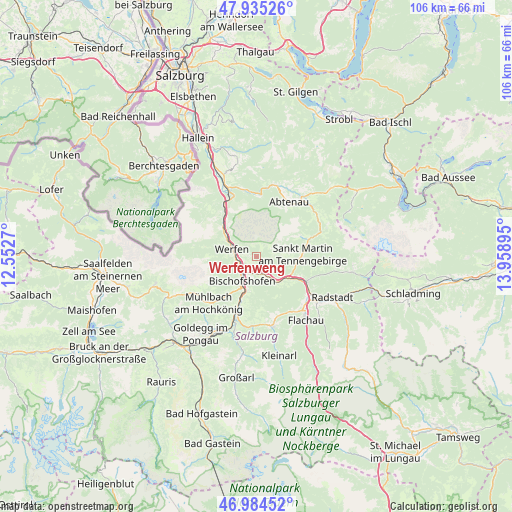
Werfenweng GPS coordinates[2]
47° 27' 43.344" North, 13° 15' 20.952" East
| Map corner | latitude | longitude |
|---|---|---|
| Upper-left | 47.93526°, | 12.5527° |
| Center: | 47.46204°, | 13.25582° |
| Lower-right: | 46.98452°, | 13.95895° |
| Map W x H: | 105.7×105.7 km | = 65.7×65.7mi |
| max Lat: | 48.98333° ⇑55.9% North |
| Werfenweng: | 47.46204° |
| min Lat: | ⇓44.1% South 46.48841° |
| min Long | Werfenweng | max Long |
| 9.57802° | 13.25582° | 17.1° |
| W 21.8%⇐ | ⇒78.2% E |
Elevation
Elevation of Werfenweng is 890 m = 2920 ft, and this is 384.5 m = 1261 ft above average elevation for this country.
| Max E: |
2140 m = 7021 ft | 9.6% |
| Werfenweng | 890 m 2920 ft | |
| Avg. | 505.5 m = 1658 ft | |
Min E: |
118 m = 387 ft | 90.4% |
See also: Austria elevation on elevation.city.
Geographical zone
Werfenweng is located in North temperate zone (between Tropic of Cancer and the Arctic Circle). Distance of this North polar circle is 2123.9 km =1319.7 mi to North.| Distance of | km | miles | from Werfenweng |
|---|---|---|---|
| North Pole | 4729.8 | 2939 | to North |
| Arctic Circle | 2123.9 | 1319.7 | to North |
| Tropic Cancer | 2671.4 | 1659.9 | to South |
| Equator | 5277.3 | 3279.2 | to South |


Nearby cities:
15 places around Werfenweng: (largest is in red/bold)
• Au
12.3 km =7.6 mi,  30°
30°
• Bischofshofen
5.8 km =3.6 mi,  210°
210°
• Dorfwerfen
3.8 km =2.4 mi,  264°
264°
• Hüttau
6.4 km =4 mi,  142°
142°
• Laideregg
6.6 km =4.1 mi,  219°
219°
• Lammertal
9.2 km =5.7 mi,  64°
64°
• Maschl
11.4 km =7.1 mi,  201°
201°
• Mitterberghütten
7.5 km =4.7 mi, 203°
• Neubach
11.7 km =7.3 mi,  72°
72°
• Pfarrwerfen
3.8 km =2.4 mi, 262°
• Rettenstein
12.8 km =8 mi,  193°
193°
• Sonnberg
6.8 km =4.2 mi, 137°
• St. Martin of Tennengebirge
9.2 km =5.7 mi,  87°
87°
• Sulzau
7.9 km =4.9 mi,  302°
302°
• Werfen
5.2 km =3.2 mi,  287°
287°
Sources, notices
• [Note1] Compared only with cities in Austria existing in our database
• [Src1] Map data: © OpenStreetMap contributors (CC-BY-SA)
• [Src2] Other city data from geonames.org with taken over terms of usage.
• [Src3] Geographical zone / Annual Mean Temperature by Robert A. Rohde @ Wikipedia
