Altendorf geodata
Altendorf (Lower Austria) is a seat of a third-order administrative division; located in Austria in Europe/Vienna (GMT+2) time zone. With population of 194 people, there are 2856 cities with bigger population in this country. Compared to other cities in Austria, 51.9% of cities are located further ↓South; 80.7% of cities are located further ←West and 74.7% of cities have lower elevation than Altendorf. Note1
Administrative division(s):
- Level 1: Lower Austria
- Level 2: Politischer Bezirk Neunkirchen
- Level 3: Altendorf


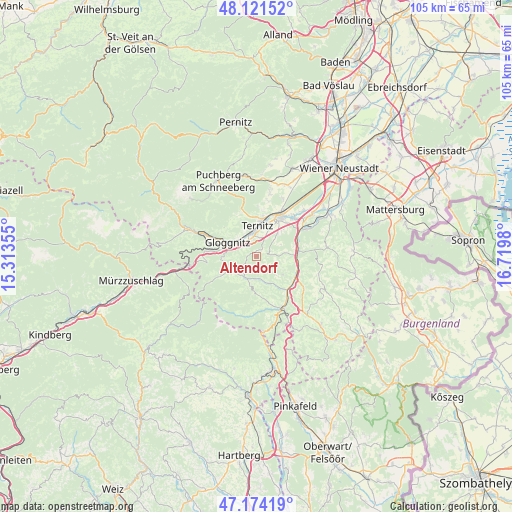
Altendorf GPS coordinates[2]
47° 39' 0" North, 16° 1' 0.012" East
| Map corner | latitude | longitude |
|---|---|---|
| Upper-left | 48.12152°, | 15.31355° |
| Center: | 47.65°, | 16.01667° |
| Lower-right: | 47.17419°, | 16.7198° |
| Map W x H: | 105.3×105.3 km | = 65.4×65.4mi |
| max Lat: | 48.98333° ⇑48.1% North |
| Altendorf: | 47.65° |
| min Lat: | ⇓51.9% South 46.48841° |
| min Long | Altendorf | max Long |
| 9.57802° | 16.01667° | 17.1° |
| W 80.7%⇐ | ⇒19.3% E |
Elevation
Elevation of Altendorf is 644 m = 2113 ft, and this is 138.5 m = 454 ft above average elevation for this country.
| Max E: |
2140 m = 7021 ft | 25.3% |
| Altendorf | 644 m 2113 ft | |
| Avg. | 505.5 m = 1658 ft | |
Min E: |
118 m = 387 ft | 74.7% |
See also: Austria elevation on elevation.city.
Geographical zone
Altendorf is located in North temperate zone (between Tropic of Cancer and the Arctic Circle). Distance of this North polar circle is 2103 km =1306.7 mi to North.| Distance of | km | miles | from Altendorf |
|---|---|---|---|
| North Pole | 4708.9 | 2926 | to North |
| Arctic Circle | 2103 | 1306.7 | to North |
| Tropic Cancer | 2692.3 | 1672.9 | to South |
| Equator | 5298.2 | 3292.1 | to South |


Nearby cities:
15 places around Altendorf: (largest is in red/bold)
• Buchbach
5.7 km =3.5 mi,  334°
334°
• Enzenreith
5.2 km =3.2 mi,  293°
293°
• Feistritz am Wechsel
6.1 km =3.8 mi,  155°
155°
• Gloggnitz
6.4 km =4 mi,  295°
295°
• Grafenbach
3.4 km =2.1 mi,  348°
348°
• Kirchberg am Wechsel
5.1 km =3.2 mi,  202°
202°
• Otterthal
7.3 km =4.5 mi,  239°
239°
• Pottschach
5.4 km =3.4 mi, 352°
• Putzmannsdorf
4.9 km =3 mi,  342°
342°
• Raach am Hochgebirge
6.5 km =4 mi,  253°
253°
• Sankt Valentin-Landschach
3.7 km =2.3 mi,  0°
0°
• Stuppach
5.2 km =3.2 mi,  310°
310°
• Ternitz
7.4 km =4.6 mi,  11°
11°
• Wartmannstetten
6.5 km =4 mi,  42°
42°
• Wimpassing im Schwarzatale
6 km =3.7 mi, 11°
Sources, notices
• [Note1] Compared only with cities in Austria existing in our database
• [Src1] Map data: © OpenStreetMap contributors (CC-BY-SA)
• [Src2] Other city data from geonames.org with taken over terms of usage.
• [Src3] Geographical zone / Annual Mean Temperature by Robert A. Rohde @ Wikipedia
