Gloggnitz geodata
Gloggnitz (Lower Austria) is a seat of a third-order administrative division; located in Austria in Europe/Vienna (GMT+2) time zone. With population of 4,730 people, there are 205 cities with bigger population in this country. Compared to other cities in Austria, 52.6% of cities are located further ↓South; 78.5% of cities are located further ←West and 50.5% of cities have higher elevation than Gloggnitz. Note1
Administrative division(s):
- Level 1: Lower Austria
- Level 2: Politischer Bezirk Neunkirchen
- Level 3: Gloggnitz


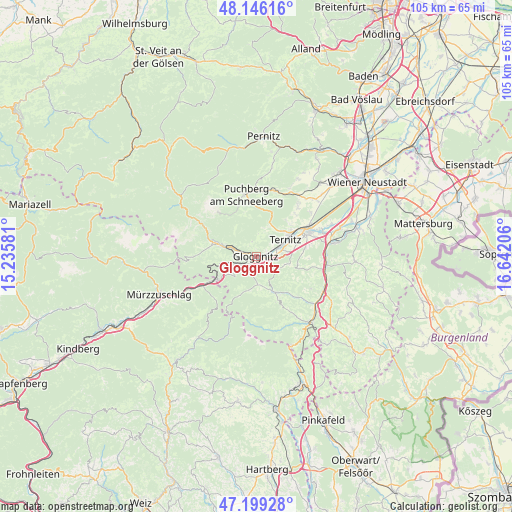
Gloggnitz GPS coordinates[2]
47° 40' 29.532" North, 15° 56' 20.148" East
| Map corner | latitude | longitude |
|---|---|---|
| Upper-left | 48.14616°, | 15.23581° |
| Center: | 47.67487°, | 15.93893° |
| Lower-right: | 47.19928°, | 16.64206° |
| Map W x H: | 105.3×105.3 km | = 65.4×65.4mi |
| max Lat: | 48.98333° ⇑47.4% North |
| Gloggnitz: | 47.67487° |
| min Lat: | ⇓52.6% South 46.48841° |
| min Long | Gloggnitz | max Long |
| 9.57802° | 15.93893° | 17.1° |
| W 78.5%⇐ | ⇒21.5% E |
Elevation
Elevation of Gloggnitz is 448 m = 1470 ft, and this is 57.5 m = 189 ft below average elevation for this country.
| Max E: |
2140 m = 7021 ft | 50.5% |
| Avg. | 505.5 m = 1658 ft | |
| Gloggnitz | 448 m = 1470 ft | |
Min E: |
118 m = 387 ft | 49.5% |
See also: Austria elevation on elevation.city.
Geographical zone
Gloggnitz is located in North temperate zone (between Tropic of Cancer and the Arctic Circle). Distance of this North polar circle is 2100.2 km =1305 mi to North.| Distance of | km | miles | from Gloggnitz |
|---|---|---|---|
| North Pole | 4706.1 | 2924.2 | to North |
| Arctic Circle | 2100.2 | 1305 | to North |
| Tropic Cancer | 2695 | 1674.6 | to South |
| Equator | 5300.9 | 3293.8 | to South |


Nearby cities:
15 places around Gloggnitz: (largest is in red/bold)
• Altendorf
6.4 km =4 mi,  115°
115°
• Buchbach
4.2 km =2.6 mi,  54°
54°
• Enzenreith
1.2 km =0.7 mi,  125°
125°
• Grafenbach
5.1 km =3.2 mi,  83°
83°
• Otterthal
6.5 km =4 mi,  183°
183°
• Payerbach
6 km =3.7 mi,  288°
288°
• Pottschach
5.8 km =3.6 mi,  62°
62°
• Prigglitz
3.3 km =2.1 mi,  345°
345°
• Putzmannsdorf
4.7 km =2.9 mi,  66°
66°
• Raach am Hochgebirge
4.6 km =2.9 mi,  185°
185°
• Reichenau an der Rax
7.3 km =4.5 mi, 287°
• Sankt Valentin-Landschach
5.9 km =3.7 mi, 80°
• Schottwien
5.4 km =3.4 mi,  248°
248°
• Stuppach
2 km =1.2 mi, 72°
• Wimpassing im Schwarzatale
7.7 km =4.8 mi, 66°
Sources, notices
• [Note1] Compared only with cities in Austria existing in our database
• [Src1] Map data: © OpenStreetMap contributors (CC-BY-SA)
• [Src2] Other city data from geonames.org with taken over terms of usage.
• [Src3] Geographical zone / Annual Mean Temperature by Robert A. Rohde @ Wikipedia
